File:Generisches spurmodell.pdf
 Size of this JPG preview of this PDF file: 424 × 600 pixels. Other resolutions: 170 × 240 pixels | 339 × 480 pixels | 543 × 768 pixels | 1,239 × 1,752 pixels. |
Original file (1,239 × 1,752 pixels, file size: 675 KB, MIME type: application/pdf, 11 pages)
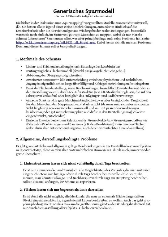
Generic lane model-proposal in German created by me (Fabi2), which addresses the problem that it is not always clear what belongs to a street in the legal sense. This also show an idea for routing between area/area and area/way. Area routing works by tagging all possible legal/physical crossings with relations and then connect the midpoints of them to get a routing graph. A good idea for a heuristic, which shows the route over areas as a nice picture without crossing area corners, is still needed. Maybe it can be constructed with splines.
- This media file was uploaded by author of the work and its copyright holder.
![]()
![]()
![]()
Attribution: Fabi2
File history
Click on a date/time to view the file as it appeared at that time.
| Date/Time | Thumbnail | Dimensions | User | Comment | |
|---|---|---|---|---|---|
| current | 03:24, 9 November 2012 |  | 1,239 × 1,752, 11 pages (675 KB) | Fabi2 (talk | contribs) |
You cannot overwrite this file.
File usage
The following 3 pages use this file: