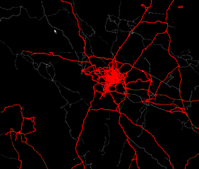
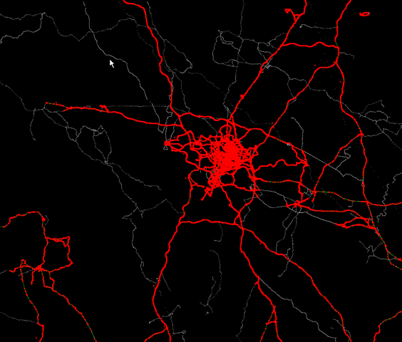
File:Greater Midlands Area - JOSM.png
Jump to navigation
Jump to search


Size of this preview: 704 × 600 pixels. Other resolutions: 282 × 240 pixels | 564 × 480 pixels | 925 × 788 pixels.
Original file (925 × 788 pixels, file size: 36 KB, MIME type: image/png)
Image snagged from Imi's JOSM detailing the gpx tracks, nodes and line segments in the greater midlands area of the UK. Bounding box approximately lat 52 to 53 and lon -3 to -1.
File history
Click on a date/time to view the file as it appeared at that time.
| Date/Time | Thumbnail | Dimensions | User | Comment | |
|---|---|---|---|---|---|
| current | 11:53, 12 January 2006 | | 925 × 788 (36 KB) | Blackadder (talk | contribs) | Image snagged from Imi's JOSM detailing the gpx tracks, nodes and line segments in the greater midlands area of the UK. Bounding box approximately lat 52 to 53 and lon -3 to -1. |
You cannot overwrite this file.
File usage
The following page uses this file: