File:Haiti earthquake damage map.png
Jump to navigation
Jump to search

No higher resolution available.
Haiti_earthquake_damage_map.png (682 × 469 pixels, file size: 209 KB, MIME type: image/png)
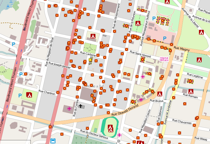
Example zoomed in area of former Haiti renderer on openstreetmap.nl The Haiti custom rendering set up by User:Ldp which shows damaged buildings and refugee camps mapped within OpenStreetMap using special GeoEye/DigitalGlobe imagery. See WikiProject Haiti#2010 Earthquake Response
![]()
Contains map data © OpenStreetMap contributors, made available under the terms of the Creative Commons Attribution-ShareAlike 2.0 (CC-BY-SA-2.0).
File history
Click on a date/time to view the file as it appeared at that time.
| Date/Time | Thumbnail | Dimensions | User | Comment | |
|---|---|---|---|---|---|
| current | 14:14, 17 January 2010 | | 682 × 469 (209 KB) | Petschge (talk | contribs) | (Updated example zoomed in area of http://haiti.openstreetmap.nl/ The Haiti custom rendering set up by User:Ldp User:Ldp which shows damaged buildings and refugee camps mapped within OpenStreetMap using special GeoEye/DigitalGlobe imagery. See WikiPro |
| 14:14, 16 January 2010 | 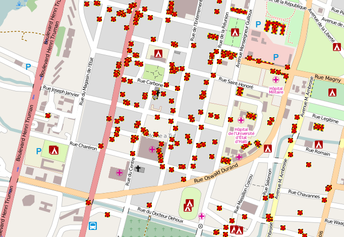 | 682 × 469 (209 KB) | Harry Wood (talk | contribs) | Example zoomed in area of http://haiti.openstreetmap.nl/ The Haiti custom rendering set up by User:Ldp which shows damaged buildings and refugee camps mapped within OpenStreetMap using special GeoEye/DigitalGlobe imagery. See [[WikiProject Haiti#2010 |
You cannot overwrite this file.
File usage
The following page uses this file: