File:Haiti highway residential.mapped.png
Jump to navigation
Jump to search

No higher resolution available.
Haiti_highway_residential.mapped.png (326 × 272 pixels, file size: 244 KB, MIME type: image/png)
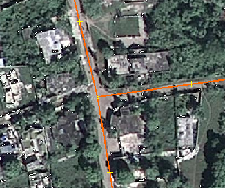
Sample of two roads to be tagged with highway=residential. Including OSM data artefacts.
File history
Click on a date/time to view the file as it appeared at that time.
| Date/Time | Thumbnail | Dimensions | User | Comment | |
|---|---|---|---|---|---|
| current | 15:26, 19 January 2010 | | 326 × 272 (244 KB) | Gubaer (talk | contribs) | Sample of two roads to be tagged with highway=residential. Including OSM data artefacts. |
You cannot overwrite this file.
File usage
The following page uses this file: