File:Hartlepool Mapping Areas.png
Jump to navigation
Jump to search


Size of this preview: 410 × 599 pixels. Other resolutions: 164 × 240 pixels | 607 × 887 pixels.
Original file (607 × 887 pixels, file size: 346 KB, MIME type: image/png)
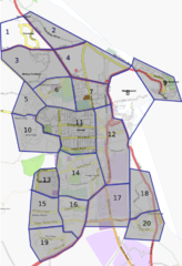
Map of Hartlepool Divided up so we can track progress with completion.
File history
Click on a date/time to view the file as it appeared at that time.
| Date/Time | Thumbnail | Dimensions | User | Comment | |
|---|---|---|---|---|---|
| current | 14:14, 2 May 2010 | | 607 × 887 (346 KB) | Grahamjones (talk | contribs) | Headland, West View and King Oswy now shown complete |
| 21:44, 28 February 2010 | 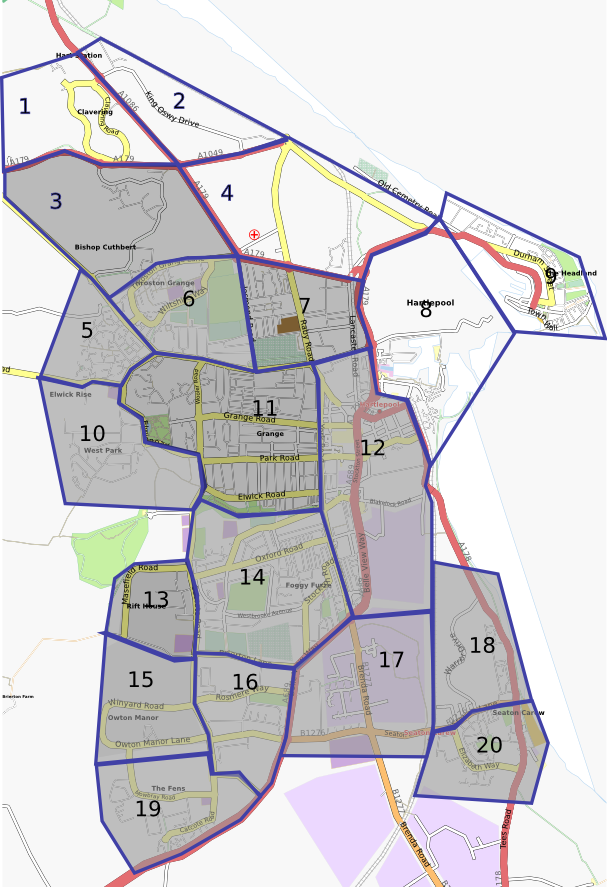 | 607 × 887 (348 KB) | Grahamjones (talk | contribs) | Dyke House now shown complete | |
| 21:48, 14 February 2010 | 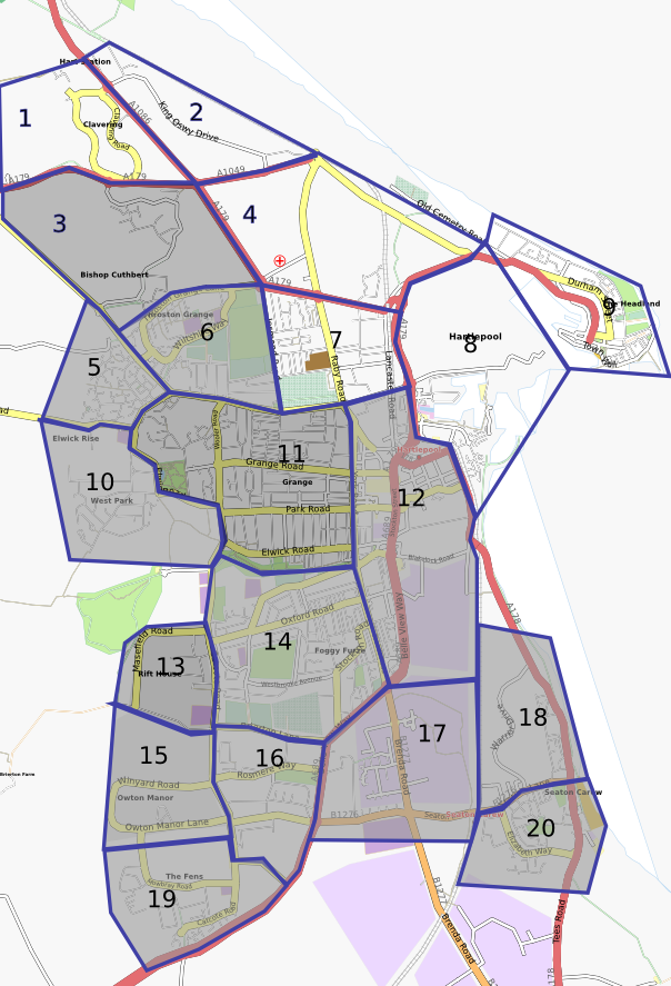 | 604 × 887 (347 KB) | Grahamjones (talk | contribs) | Updated to show completion of all southern Hartlepool | |
| 19:29, 20 September 2009 | 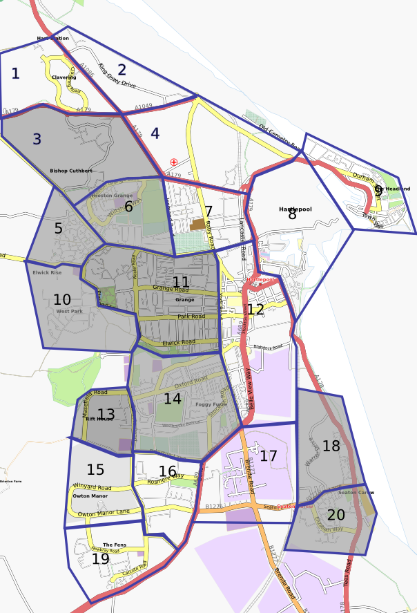 | 604 × 887 (359 KB) | Grahamjones (talk | contribs) | Updated to show Grange area as complete. | |
| 15:20, 13 September 2009 | 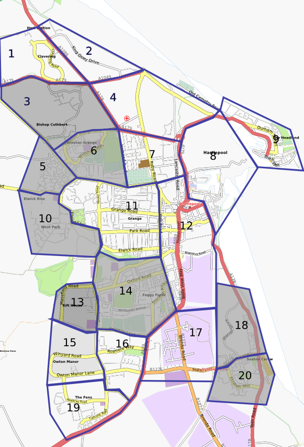 | 604 × 887 (361 KB) | Grahamjones (talk | contribs) | Image of Hartlepool map showing what has been completed. | |
| 21:46, 21 May 2009 | 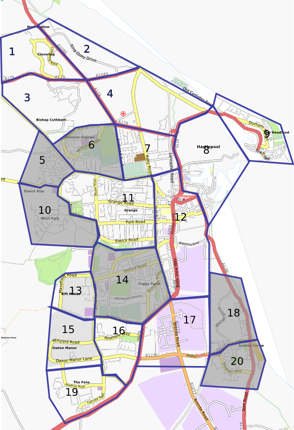 | 607 × 887 (363 KB) | Grahamjones (talk | contribs) | Hartlepool sliced into bits so I can track how near to finished it is. | |
| 22:33, 12 April 2009 | 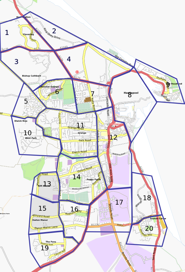 | 607 × 892 (377 KB) | Grahamjones (talk | contribs) | Map of Hartlepool Divided up so we can track progress with completion. |
You cannot overwrite this file.
File usage
The following page uses this file: