File:HenryStreet.all.plain.svg
Jump to navigation
Jump to search


Size of this PNG preview of this SVG file: 441 × 408 pixels. Other resolutions: 259 × 240 pixels | 519 × 480 pixels | 830 × 768 pixels | 1,107 × 1,024 pixels.
Original file (SVG file, nominally 441 × 408 pixels, file size: 86 KB)
Summary
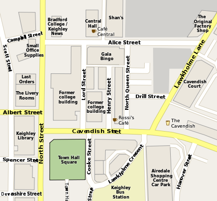
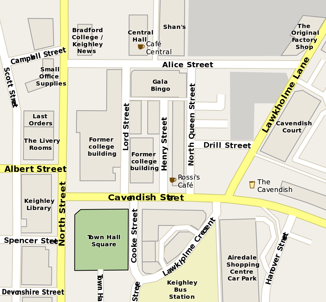
Map of central Keighley developed with Maperitive and Inkscape
Licensing
![]()
![]()
![]()
This work is licensed under the Creative Commons Attribution-ShareAlike 2.0 License.
Attribution not specified as a parameter! THIS LICENSE ALWAYS REQUIRES ATTRIBUTION! Use {{CC-BY-SA-2.0|Attribution, typically name of author}} See Template:CC-BY-SA-2.0 for full description how this template should be used.
Note, there is
There is also
Attribution not specified as a parameter! THIS LICENSE ALWAYS REQUIRES ATTRIBUTION! Use {{CC-BY-SA-2.0|Attribution, typically name of author}} See Template:CC-BY-SA-2.0 for full description how this template should be used.
Note, there is
{{CC-BY-SA-2.0 OpenStreetMap}} for files based on old OSM map data, before the license change made on 2012-09-12.There is also
{{OSM Carto screenshot||old_license}} for files based on old OSM map data, before the license change made on 2012-09-12, created using OSM Carto map style.
File history
Click on a date/time to view the file as it appeared at that time.
| Date/Time | Thumbnail | Dimensions | User | Comment | |
|---|---|---|---|---|---|
| current | 21:39, 24 April 2012 | | 441 × 408 (86 KB) | LeedsTracker (talk | contribs) | Map of central Keighley developed with Maperitive and Inkscape |
You cannot overwrite this file.
File usage
There are no pages that use this file.