File:Horsey island.jpg
Jump to navigation
Jump to search

Size of this preview: 800 × 525 pixels. Other resolutions: 320 × 210 pixels | 640 × 420 pixels | 848 × 557 pixels.
Original file (848 × 557 pixels, file size: 143 KB, MIME type: image/jpeg)
Summary
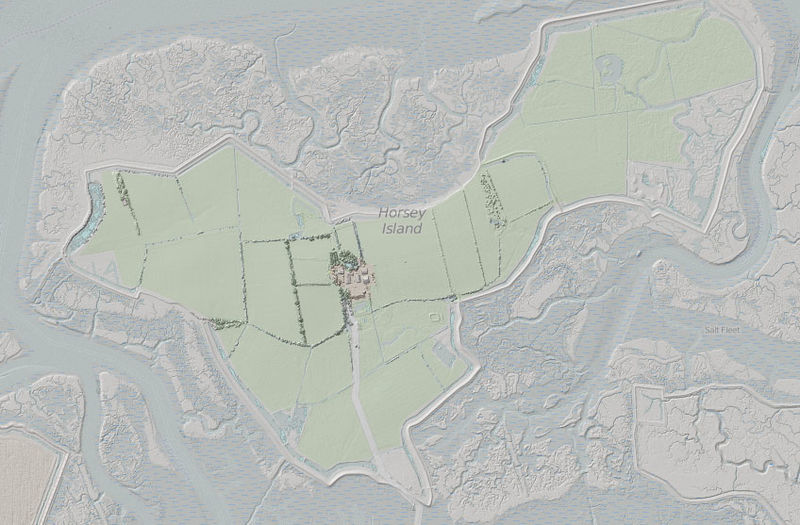
EA (England) Lidar data compared with OSM Mapnik layer for Horsey Island, Essex. Note the detail of channels in mud flats and salt marsh.
This area is that which the "Swallows & Amazons" survey using traditional techniques in Secret Water.
Licensing
| Contains map data © OpenStreetMap contributors, made available under the terms of the Open Database License (ODbL).
The ODbL does not require any particular license for maps produced from ODbL data, produced maps may be subject also to other licences. |
File history
Click on a date/time to view the file as it appeared at that time.
| Date/Time | Thumbnail | Dimensions | User | Comment | |
|---|---|---|---|---|---|
| current | 14:44, 21 October 2015 | | 848 × 557 (143 KB) | SK53 (talk | contribs) | EA (England) Lidar data compared with OSM Mapnik layer for Horsey Island, Essex. Note the detail of channels in mud flats and salt marsh. This area is that which the "Swallows & Amazons" survey using traditional techniques in Secret Water. |
You cannot overwrite this file.
File usage
There are no pages that use this file.