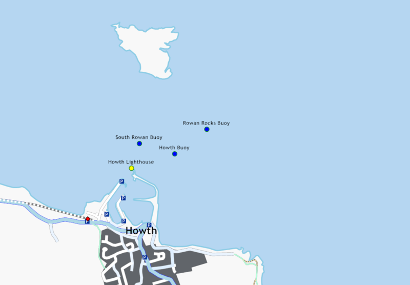
File:Howth harbour.png
Jump to navigation
Jump to search


Size of this preview: 800 × 556 pixels. Other resolutions: 320 × 222 pixels | 640 × 444 pixels | 1,034 × 718 pixels.
Original file (1,034 × 718 pixels, file size: 73 KB, MIME type: image/png)
Rendered using Kosmos
This is a Featured image, which means that it has been identified as one of the best examples of OpenStreetMap mapping, or that it provides a useful illustration of the OpenStreetMap project. If you know another image of similar quality, you can nominate it on Featured image proposals.
Front-page image on 31 May 2008
File history
Click on a date/time to view the file as it appeared at that time.
| Date/Time | Thumbnail | Dimensions | User | Comment | |
|---|---|---|---|---|---|
| current | 12:14, 10 April 2008 | | 1,034 × 718 (73 KB) | Ojw (talk | contribs) | New version, with kosmos 1.12 has sea detection, and labels moved to not overlap their icons |
| 12:28, 7 April 2008 |  | 850 × 662 (65 KB) | Ojw (talk | contribs) |
You cannot overwrite this file.
File usage
The following 4 pages use this file: