File:ITO Map - Navigable waterways.png
Jump to navigation
Jump to search
Size of this preview: 799 × 124 pixels. Other resolution: 1,121 × 174 pixels.
Original file (1,121 × 174 pixels, file size: 271 KB, MIME type: image/png)
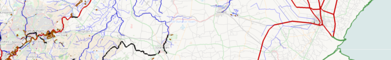
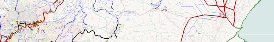
An ITO Map overlay showing navigable waterways. Waterways that have boat=no are in blue, if boat=yes then they are in red. Ones without either are shown in black. The coastline is green. Lakes are brown and reservoirs in purple.
File history
Click on a date/time to view the file as it appeared at that time.
| Date/Time | Thumbnail | Dimensions | User | Comment | |
|---|---|---|---|---|---|
| current | 21:17, 3 March 2011 | 1,121 × 174 (271 KB) | PeterIto (talk | contribs) | An ITO Map overlay showing navigable waterways. Waterways that have boat=no are in blue, if boat=yes then they are in red. Ones without either are shown in black. The coastline is green. Lakes are brown and reservoirs in purple. |
You cannot overwrite this file.
File usage
The following 3 pages use this file: