File:Import Grid.png
Jump to navigation
Jump to search

Size of this preview: 463 × 599 pixels. Other resolutions: 185 × 240 pixels | 371 × 480 pixels | 593 × 768 pixels | 791 × 1,024 pixels | 1,582 × 2,048 pixels | 5,100 × 6,600 pixels.
Original file (5,100 × 6,600 pixels, file size: 1.06 MB, MIME type: image/png)
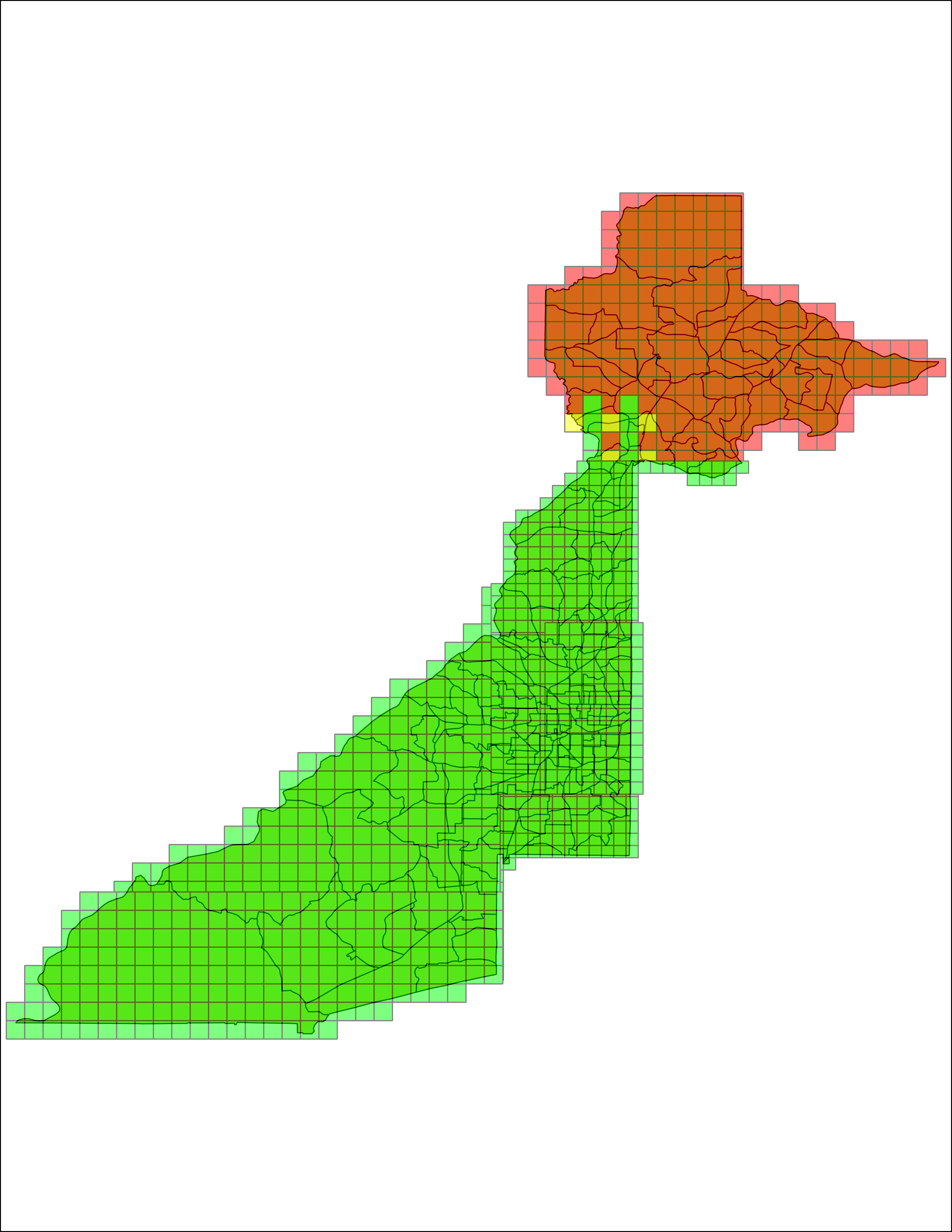
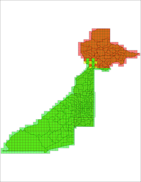
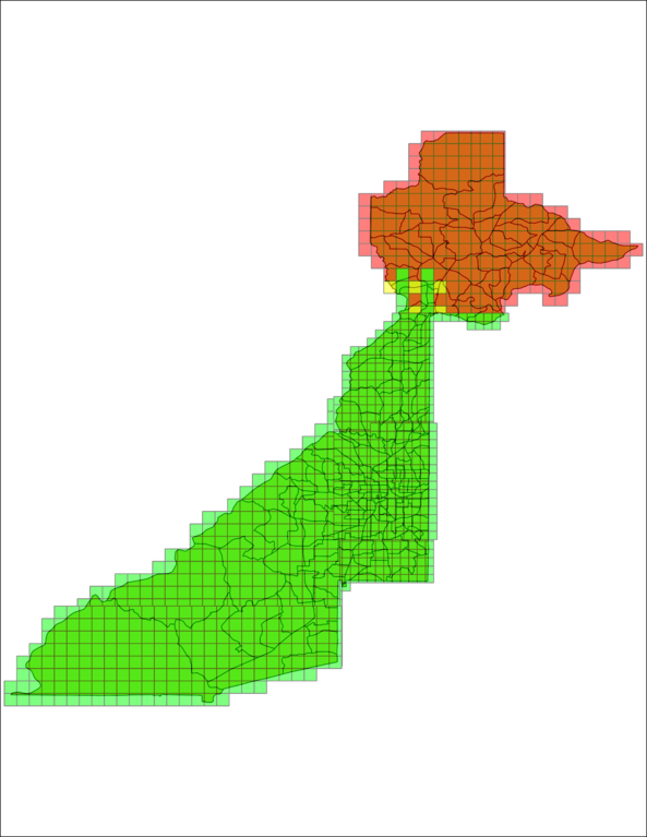
This is a screenshot of QGIS showing:
- data from the US Census Bureau for the Census tracts within Fulton County (from 2013) (downloaded from here)
- Overlay grid that I created showing what squares have been imported in OSM.
File history
Click on a date/time to view the file as it appeared at that time.
| Date/Time | Thumbnail | Dimensions | User | Comment | |
|---|---|---|---|---|---|
| current | 20:31, 15 May 2015 | | 5,100 × 6,600 (1.06 MB) | Saiarcot895 (talk | contribs) | |
| 11:34, 8 April 2015 | 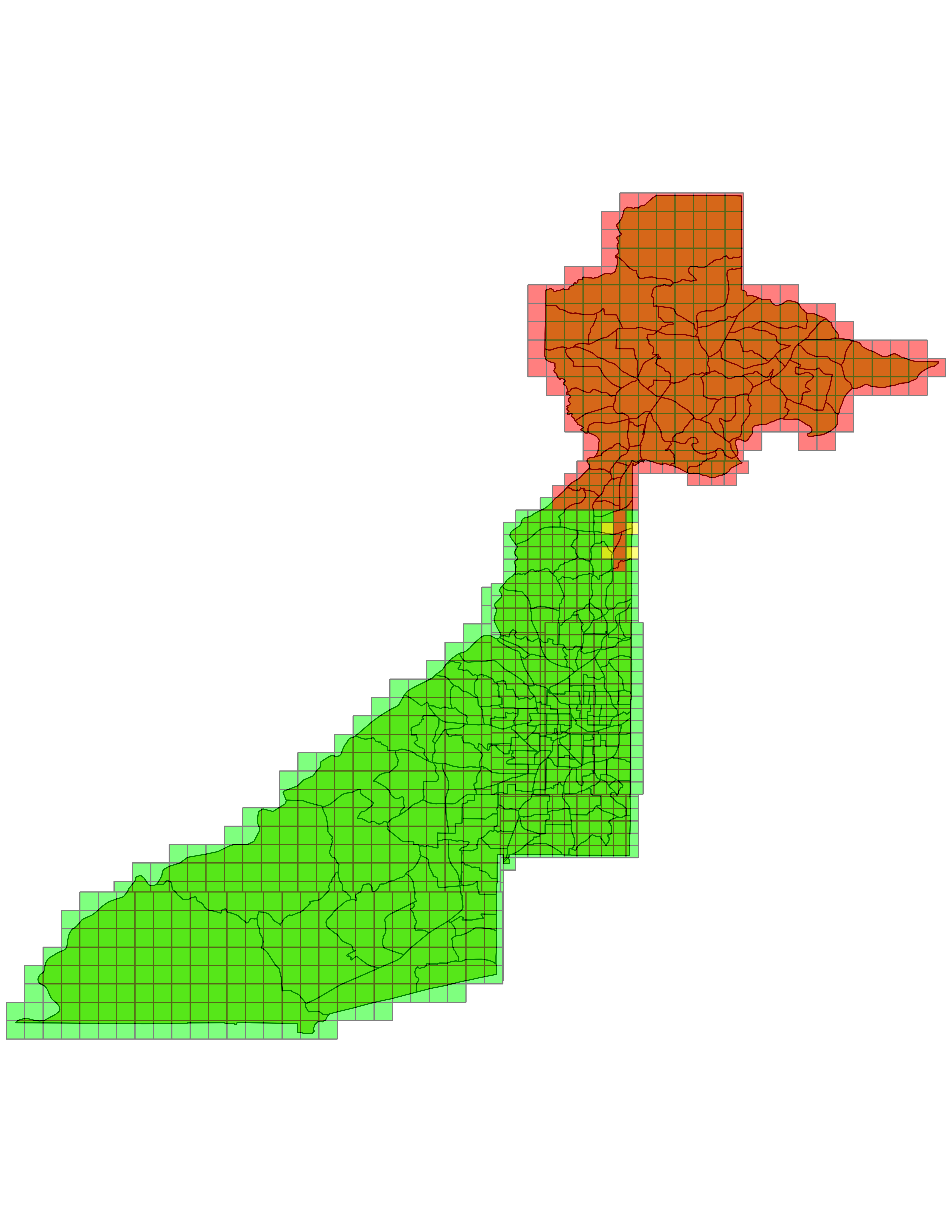 | 5,100 × 6,600 (1.06 MB) | Saiarcot895 (talk | contribs) | ||
| 12:55, 23 January 2015 |  | 5,100 × 6,600 (1.06 MB) | Saiarcot895 (talk | contribs) | ||
| 01:25, 1 June 2014 | 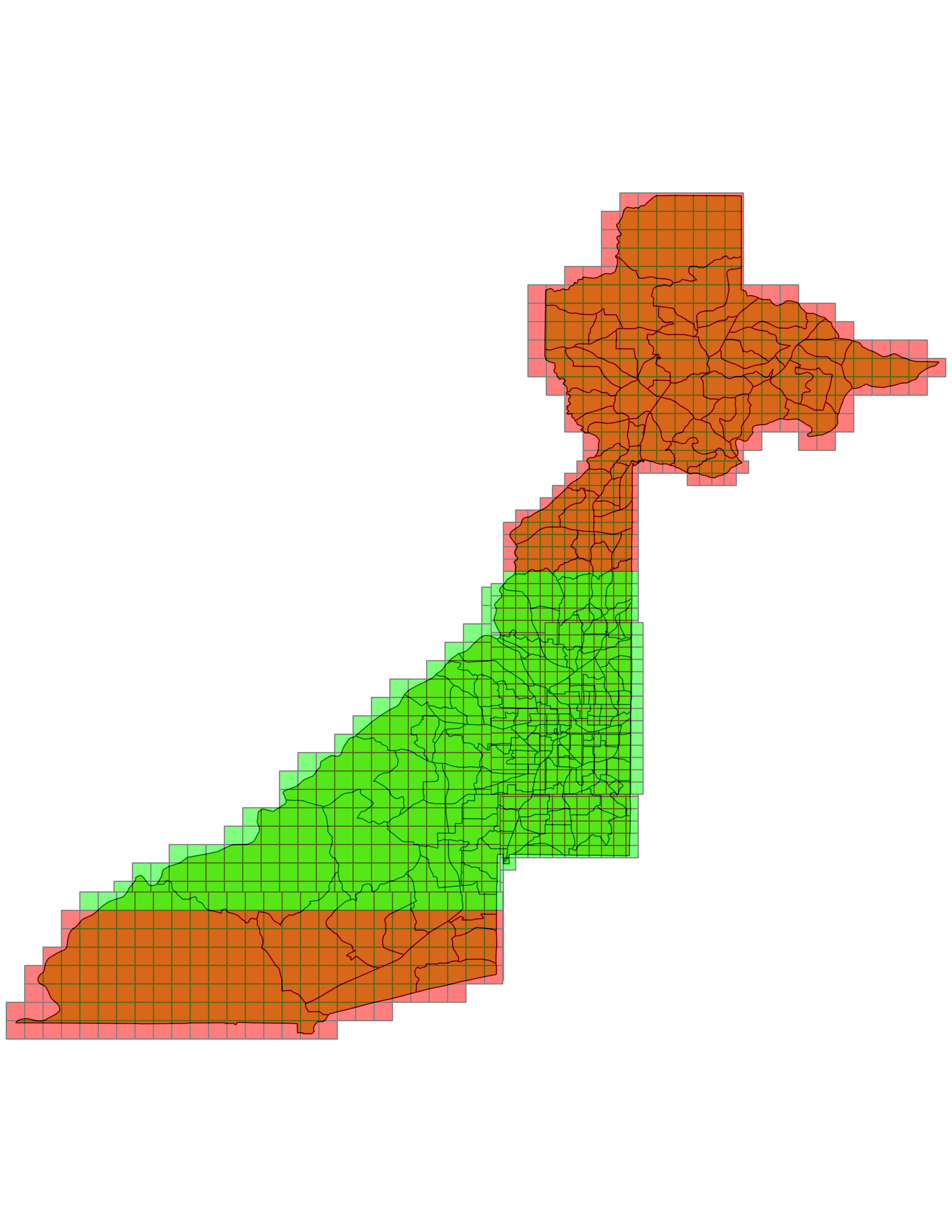 | 5,100 × 6,600 (1.06 MB) | Saiarcot895 (talk | contribs) | ||
| 13:27, 22 April 2014 | 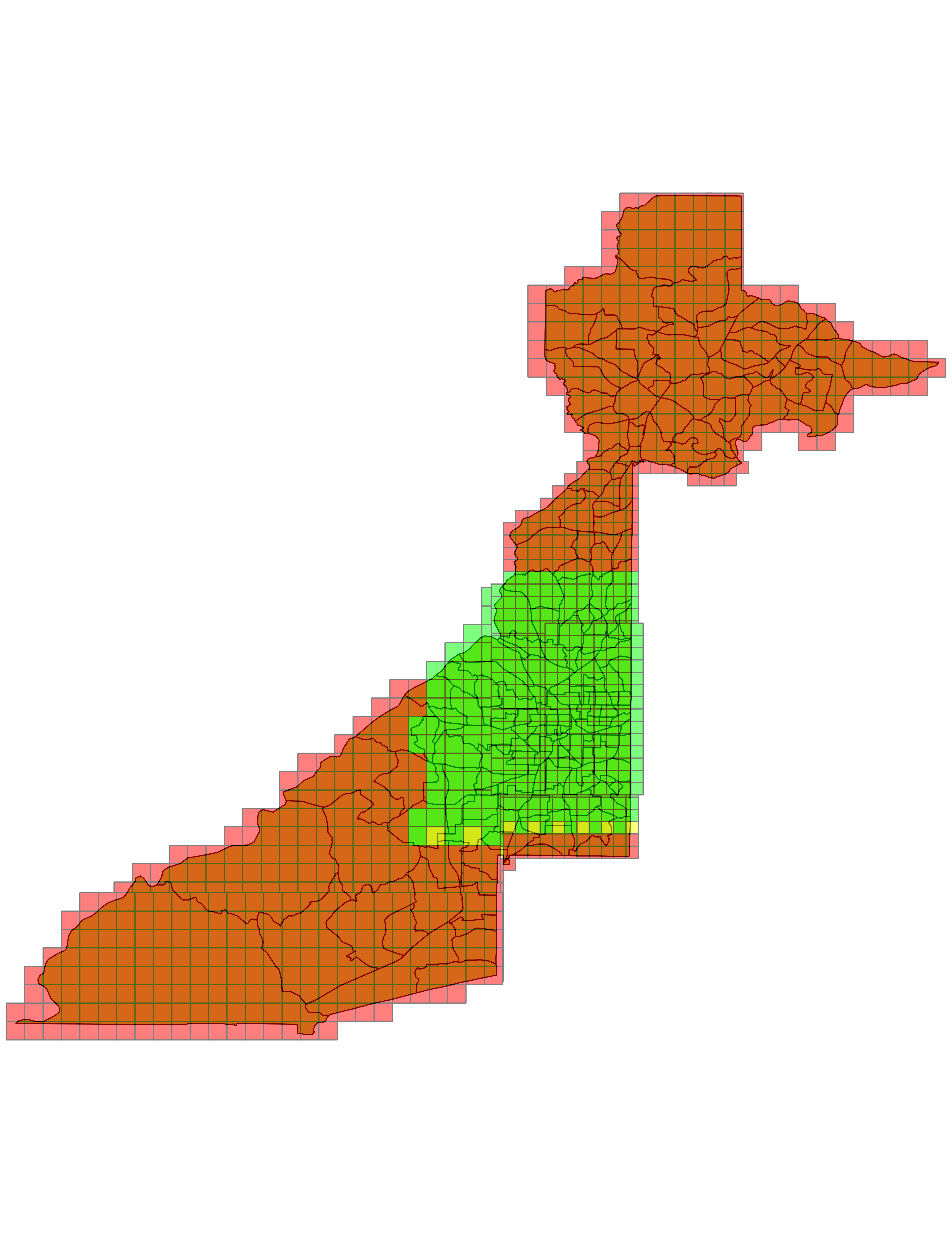 | 5,100 × 6,600 (1.06 MB) | Saiarcot895 (talk | contribs) | ||
| 18:38, 28 March 2014 | 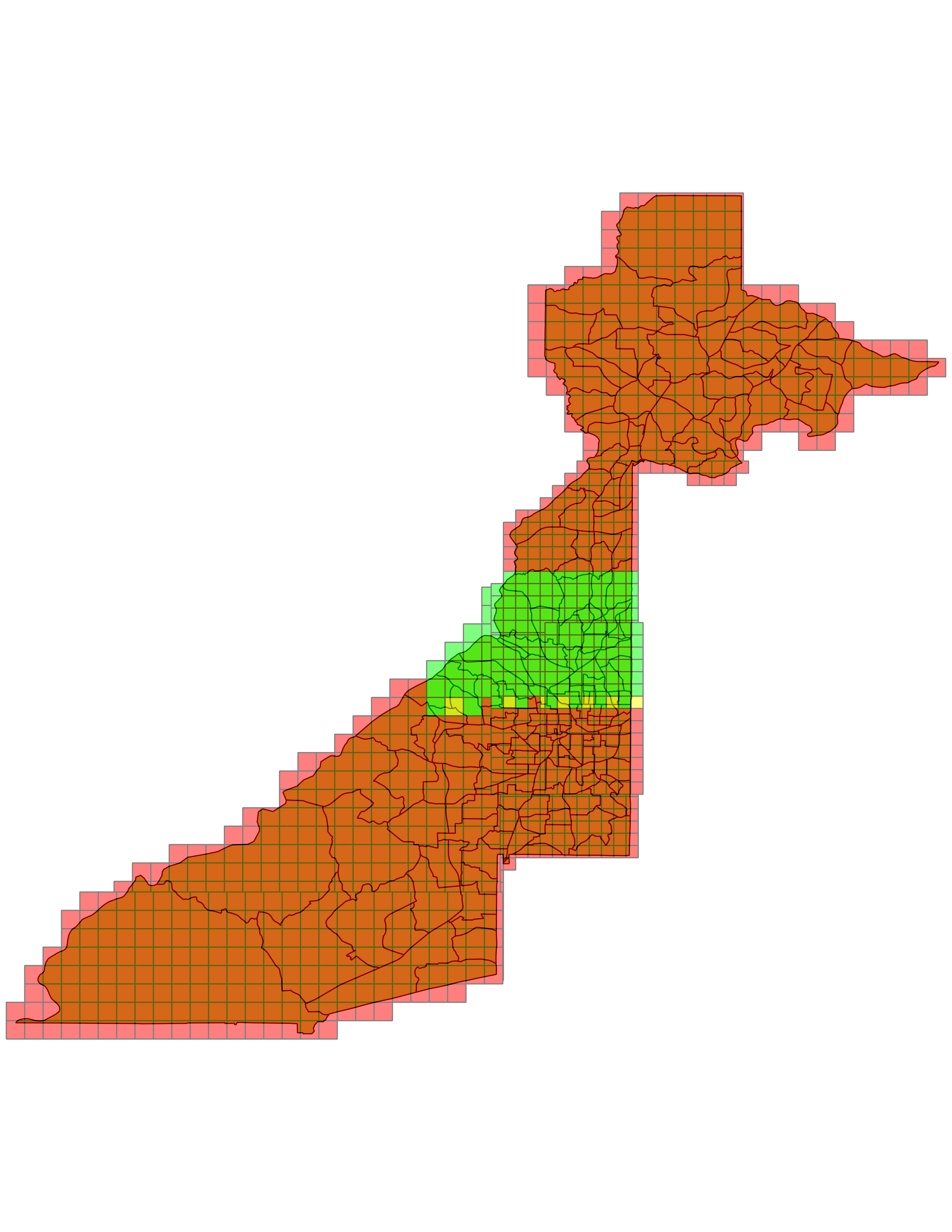 | 5,100 × 6,600 (1.03 MB) | Saiarcot895 (talk | contribs) | ||
| 22:36, 20 March 2014 | 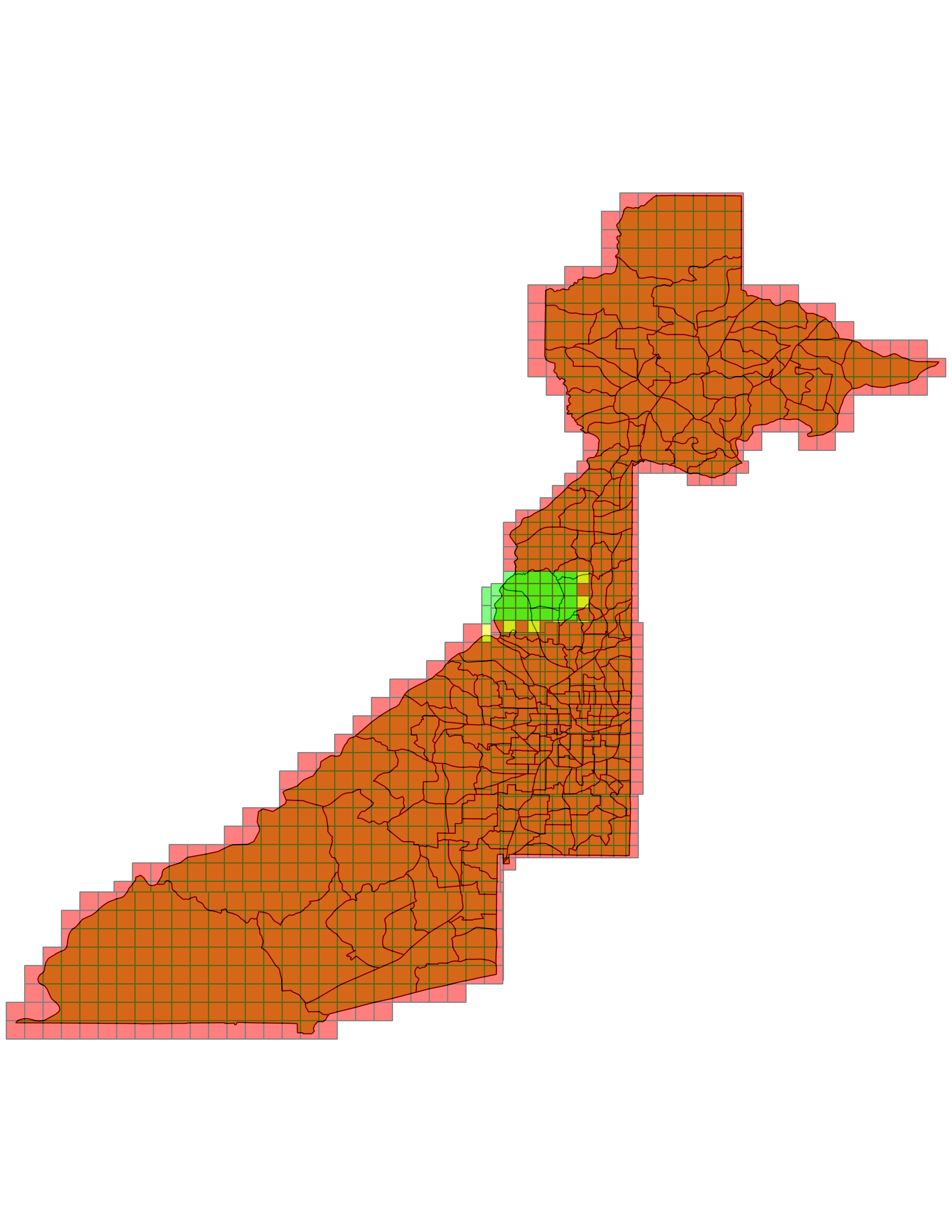 | 5,100 × 6,600 (1.06 MB) | Saiarcot895 (talk | contribs) | ||
| 14:00, 17 March 2014 | 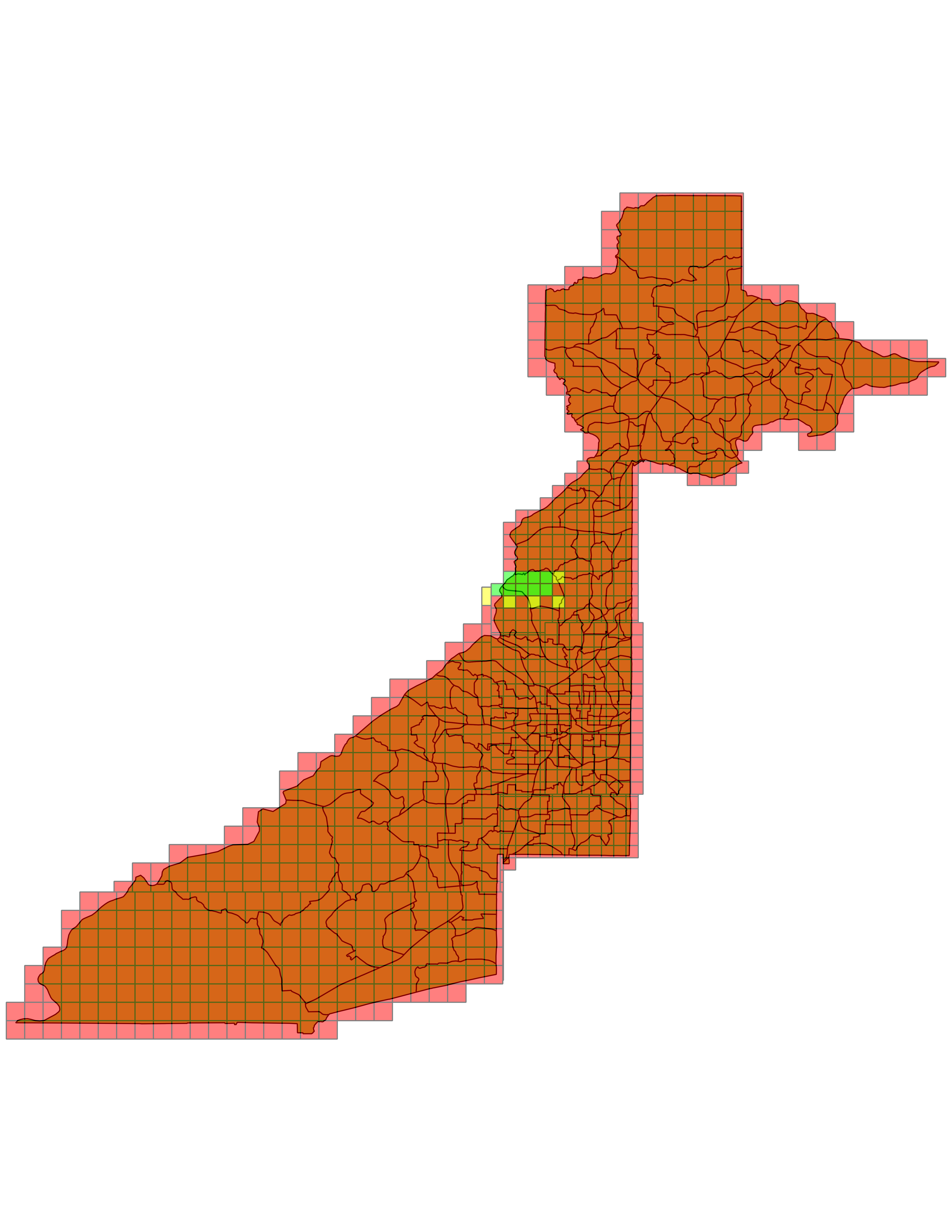 | 5,100 × 6,600 (1.03 MB) | Saiarcot895 (talk | contribs) | ||
| 13:19, 3 March 2014 | 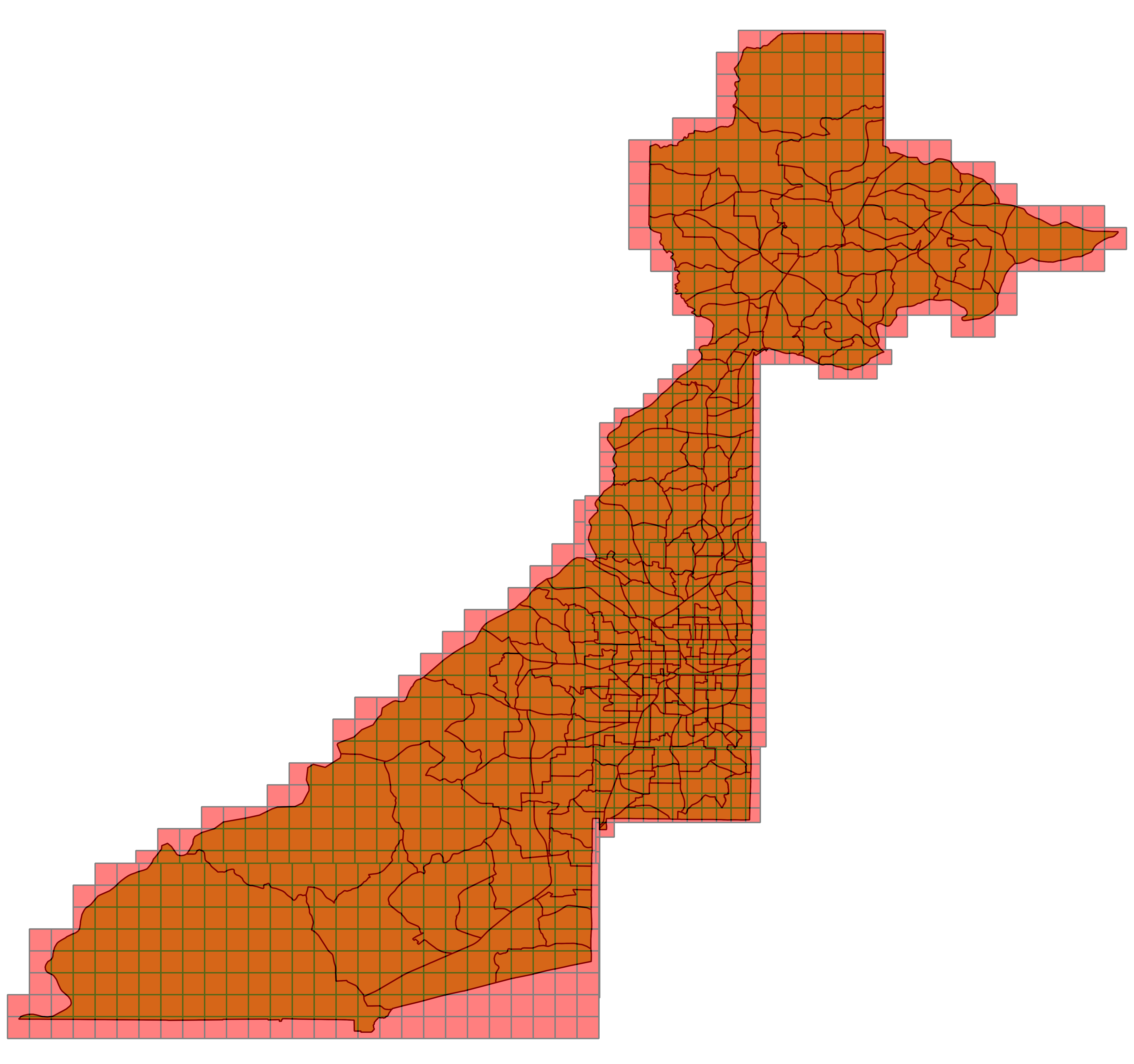 | 5,600 × 5,253 (1.24 MB) | Saiarcot895 (talk | contribs) |
You cannot overwrite this file.
File usage
The following page uses this file: