File:Int32 bits over lat.png
Jump to navigation
Jump to search
Size of this preview: 800 × 560 pixels. Other resolutions: 320 × 224 pixels | 640 × 448 pixels | 1,060 × 742 pixels.
Original file (1,060 × 742 pixels, file size: 5 KB, MIME type: image/png)
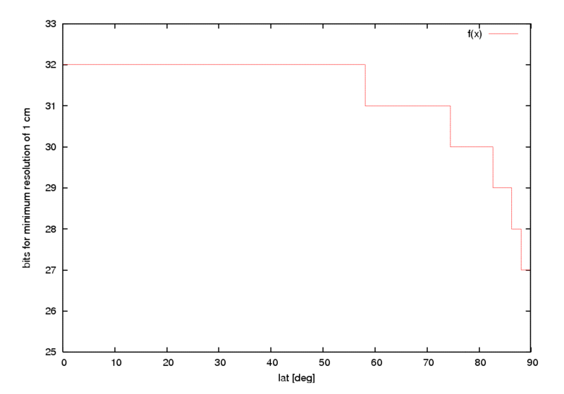
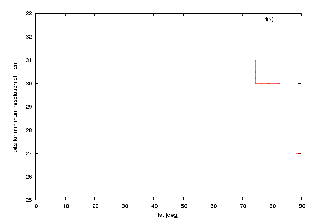
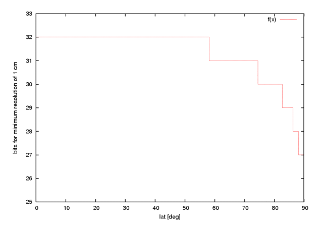
Using a binary planet.osm, coordinates can be converted from double (64bit) to int32. Bit consumption of longtiude is constantly 31 bit for 1cm resolution, and latitudes only require 32bit around the equator. As circumference decreases with increasing latitudes, some bits can be saved - at least when using a file as storage.
This graph shows how many bits are required to achieve 1cm resolution for lat values; The actual savings depend on node distribution.
Looks like it's not very much.
File history
Click on a date/time to view the file as it appeared at that time.
| Date/Time | Thumbnail | Dimensions | User | Comment | |
|---|---|---|---|---|---|
| current | 20:26, 7 September 2006 | | 1,060 × 742 (5 KB) | Wollschaf (talk | contribs) | Using a binary planet.osm, coordinates can be converted from double (64bit) to int32. Bit consumption of lon is constantly 32bit for 1cm resolution, but latitudes only require 32bit around the equator. As circumference decreases with increasing latitudes |
You cannot overwrite this file.
File usage
There are no pages that use this file.