File:Is the gabled roof a level.png
Jump to navigation
Jump to search

Size of this preview: 740 × 599 pixels. Other resolutions: 296 × 240 pixels | 593 × 480 pixels | 942 × 763 pixels.
Original file (942 × 763 pixels, file size: 574 KB, MIME type: image/png)
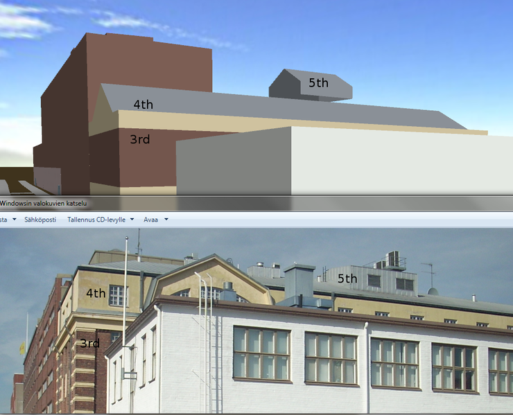
Illustration for the discussion on building:roof:*=* modelling.
File history
Click on a date/time to view the file as it appeared at that time.
| Date/Time | Thumbnail | Dimensions | User | Comment | |
|---|---|---|---|---|---|
| current | 16:09, 2 June 2012 | | 942 × 763 (574 KB) | Alv (talk | contribs) | Illustration for the discussion on building:roof:*=* modelling. |
You cannot overwrite this file.
File usage
The following page uses this file: