File:IsleOfWight20060927.png
Jump to navigation
Jump to search


Size of this preview: 800 × 487 pixels. Other resolutions: 320 × 195 pixels | 640 × 390 pixels | 1,024 × 623 pixels | 1,500 × 913 pixels.
Original file (1,500 × 913 pixels, file size: 87 KB, MIME type: image/png)
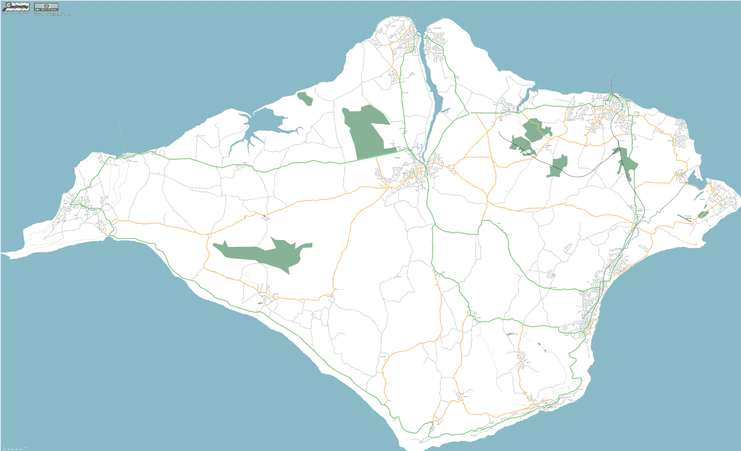
Isle of Wight, UK. As at 27 September 2006. All known roads completed, and some areas showing forest.
Map of Isle of Wight
This map and others like it, were created by OpenStreetmap contributors, and are licensed as Creative Commons CC-BY-SA 2.0 (https://creativecommons.org/licenses/by-sa/2.0/) (see OpenStreetMap licence).
Use {{mapof|PlaceName}} to add this template to your images.
This map and others like it, were created by OpenStreetmap contributors, and are licensed as Creative Commons CC-BY-SA 2.0 (https://creativecommons.org/licenses/by-sa/2.0/) (see OpenStreetMap licence).
Use {{mapof|PlaceName}} to add this template to your images.
This is a Featured image, which means that it has been identified as one of the best examples of OpenStreetMap mapping, or that it provides a useful illustration of the OpenStreetMap project. If you know another image of similar quality, you can nominate it on Featured image proposals.
Front-page image on 14 Oct 2006
File history
Click on a date/time to view the file as it appeared at that time.
| Date/Time | Thumbnail | Dimensions | User | Comment | |
|---|---|---|---|---|---|
| current | 22:46, 27 September 2006 | | 1,500 × 913 (87 KB) | Dmgroom (talk | contribs) | Isle of Wight, UK. As at 27 September 2006. All known roads completed, and some areas showing forest. |
You cannot overwrite this file.
File usage
The following 4 pages use this file: