File:Junction braid aerial.png
Junction_braid_aerial.png (558 × 484 pixels, file size: 510 KB, MIME type: image/png)
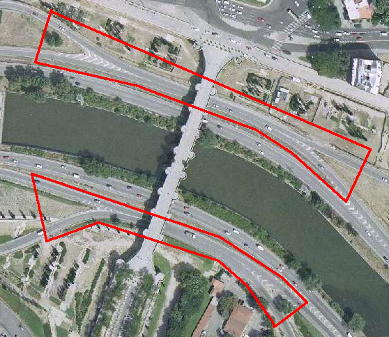
Aerial image is from the old "Marqués de Vadillo" urban highway interchange, before the whole M-30 motorway was reworked into a tunnel network. Original is available in the "nomecalles" GIS, at http://www.madrid.org/nomecalles/Inicio.icm?&left=438809&right=439981&bottom=4472059&top=4472552&fondo=Foto2004
Now those braids aren't there, it's all a (quite complex) subterranean interchange.
The [legal disclaimer for "nomecalles"](https://www.madrid.org/nomecalles/DescargaBDTCorte.icm) does not implement any well-knwo license but «allows reproduction, copying and distribution is permitted provided that the source is acknowledged, and contents are not handled, altered or used directly for commercial purposes.»
File history
Click on a date/time to view the file as it appeared at that time.
| Date/Time | Thumbnail | Dimensions | User | Comment | |
|---|---|---|---|---|---|
| current | 18:12, 1 July 2008 |  | 558 × 484 (510 KB) | Ivansanchez (talk | contribs) | Image borrowed from "nomecalles". Aerial image is from the old "Marqués de Vadillo" urban highway interchange, before the whole M-30 motorway was reworked into a tunnel network. Now those braids aren't there, it's all a (quite complex) subterranean inte |
You cannot overwrite this file.
File usage
The following 2 pages use this file:
