File:Kerjean-3.jpg
Jump to navigation
Jump to search


Size of this preview: 800 × 566 pixels. Other resolutions: 320 × 226 pixels | 640 × 453 pixels | 1,024 × 724 pixels | 1,226 × 867 pixels.
Original file (1,226 × 867 pixels, file size: 203 KB, MIME type: image/jpeg)
Summary
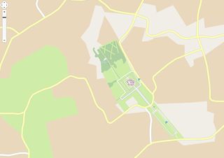
Avancée des travaux - château de Kerjean. Carte après ajouts des différentes zones enherbées et bois.
Licensing
| Contains map data © OpenStreetMap contributors, made available under the terms of the Open Database License (ODbL).
The ODbL does not require any particular license for maps produced from ODbL data, produced maps may be subject also to other licences. |
File history
Click on a date/time to view the file as it appeared at that time.
| Date/Time | Thumbnail | Dimensions | User | Comment | |
|---|---|---|---|---|---|
| current | 14:09, 18 November 2012 | | 1,226 × 867 (203 KB) | 1piedsurTerre (talk | contribs) | Avancée des travaux - château de Kerjean. Carte après ajouts des différentes zones enherbées et bois. |
You cannot overwrite this file.
File usage
The following page uses this file: