File:Kurviger-navigation.png
Jump to navigation
Jump to search

Size of this preview: 337 × 599 pixels. Other resolutions: 135 × 240 pixels | 270 × 480 pixels | 432 × 768 pixels | 1,080 × 1,920 pixels.
Original file (1,080 × 1,920 pixels, file size: 1.51 MB, MIME type: image/png)
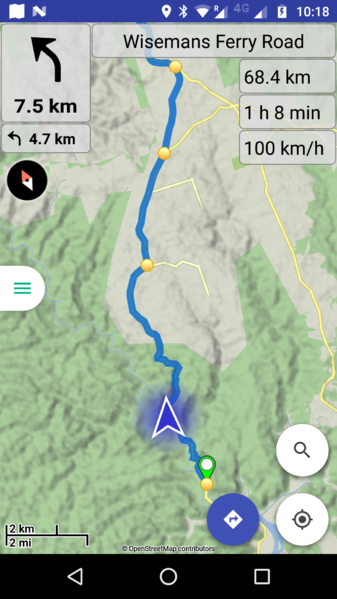
The navigation mode of the Kurviger App, routing along a curvy road in Australia.
File history
Click on a date/time to view the file as it appeared at that time.
| Date/Time | Thumbnail | Dimensions | User | Comment | |
|---|---|---|---|---|---|
| current | 23:20, 24 October 2017 | | 1,080 × 1,920 (1.51 MB) | Boldtrn (talk | contribs) |
You cannot overwrite this file.
File usage
The following 5 pages use this file: