File:LA2-Africa-UTM-zones.png
Jump to navigation
Jump to search

Size of this preview: 541 × 599 pixels. Other resolutions: 217 × 240 pixels | 433 × 480 pixels | 948 × 1,050 pixels.
Original file (948 × 1,050 pixels, file size: 225 KB, MIME type: image/png)
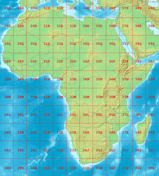
Map of Africa, showing the latitude and longitude zones of the Universal Transverse Mercator coordinate system, from 28H to 39S.
Bounding box West -18°, South -40°, East 54°, North 40°.
File history
Click on a date/time to view the file as it appeared at that time.
| Date/Time | Thumbnail | Dimensions | User | Comment | |
|---|---|---|---|---|---|
| current | 02:23, 3 September 2006 | | 948 × 1,050 (225 KB) | LA2 (talk | contribs) | Map of Africa, showing the latitude and longitude zones of the [http://en.wikipedia.org/wiki/Universal_Transverse_Mercator_coordinate_system Universal Transverse Mercator coordinate system], from 28H to 39S. Bounding box West -18°, South -40°, East 54� |
You cannot overwrite this file.
File usage
The following file is a duplicate of this file (more details):
- File:LA2-Africa-UTM-zones.png from Wikimedia Commons
The following page uses this file: