File:LA2-Europe-20070404-Russia.png
Jump to navigation
Jump to search

No higher resolution available.
LA2-Europe-20070404-Russia.png (473 × 516 pixels, file size: 62 KB, MIME type: image/png)
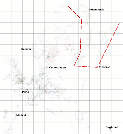
Open Street Map of Europe, based on zoom=6 Osmarender Tiles@home, as of April 4, 2007 (planet.osm), scaled down to 1/6 of original size. Grid shows zoom=6 tiles.
Red zone marks parts of Russia drawn by user:LA2 in last two weeks.
![]()
Contains map data © OpenStreetMap contributors, made available under the terms of the Creative Commons Attribution-ShareAlike 2.0 (CC-BY-SA-2.0).
File history
Click on a date/time to view the file as it appeared at that time.
| Date/Time | Thumbnail | Dimensions | User | Comment | |
|---|---|---|---|---|---|
| current | 05:59, 4 April 2007 | | 473 × 516 (62 KB) | LA2 (talk | contribs) | Open Street Map of Europe, based on zoom=6 Osmarender Tiles@home, as of April 4, 2007 (planet.osm), scaled down to 1/6 of original size. Grid shows zoom=6 tiles. Red zone marks parts of Russia drawn by user:LA2 in last two weeks. |
You cannot overwrite this file.
File usage
The following page uses this file: