File:LMP26-27-28.gif
Jump to navigation
Jump to search

No higher resolution available.
LMP26-27-28.gif (500 × 494 pixels, file size: 120 KB, MIME type: image/gif, looped, 3 frames, 5.0 s)
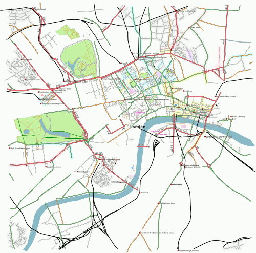
London map showing data added from London Mapping Party 27 January 2007 through to 28 January 2007, generated 29'th January at 16:00 UTC
![]()
Contains map data © OpenStreetMap contributors, made available under the terms of the Creative Commons Attribution-ShareAlike 2.0 (CC-BY-SA-2.0).
File history
Click on a date/time to view the file as it appeared at that time.
| Date/Time | Thumbnail | Dimensions | User | Comment | |
|---|---|---|---|---|---|
| current | 16:10, 29 January 2007 | | 500 × 494 (120 KB) | Dutch (talk | contribs) | |
| 07:04, 29 January 2007 |  | 500 × 494 (120 KB) | Dutch (talk | contribs) | London map showing data added from London Mapping Party 27 January 2007 through to 28 January 2007 generated on 29 January 2007 07:00 UTC | |
| 20:51, 28 January 2007 |  | 500 × 494 (115 KB) | Dutch (talk | contribs) | London map showing data added from London Mapping Party 27 January 2007 through to 28 January 2007 at 20:00 UTC | |
| 20:42, 28 January 2007 | 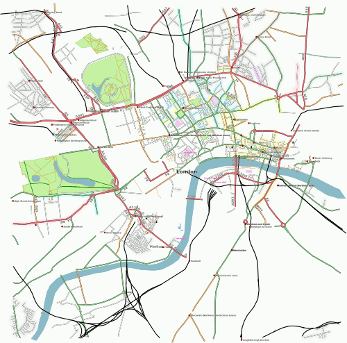 | 500 × 494 (228 KB) | Dutch (talk | contribs) | London map showing data added from London Mapping Party 27 January 2007 through to 28 January 2007 at 20:00 UTC | |
| 20:29, 28 January 2007 |  | 500 × 494 (228 KB) | Dutch (talk | contribs) | London map showing data added from London Mapping Party 27 January 2007 through to 28 January 2007 at 20:00 UTC |
You cannot overwrite this file.
File usage
The following page uses this file: