File:LincolnAreas.png
Jump to navigation
Jump to search

No higher resolution available.
LincolnAreas.png (636 × 393 pixels, file size: 144 KB, MIME type: image/png)
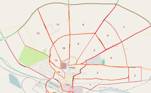
Map of Lincoln as at 17th January 2009, with numbered areas targetted for a visit there. Uploaded to add to wiki page in case anyone else wants to pick an area if they find themselves visiting Wiki unexpectedly.
![]()
Contains map data © OpenStreetMap contributors, made available under the terms of the Creative Commons Attribution-ShareAlike 2.0 (CC-BY-SA-2.0).
File history
Click on a date/time to view the file as it appeared at that time.
| Date/Time | Thumbnail | Dimensions | User | Comment | |
|---|---|---|---|---|---|
| current | 10:37, 19 January 2009 | | 636 × 393 (144 KB) | EdLoach (talk | contribs) | Map of Lincoln as at 17th January 2009, with numbered areas targetted for a visit there. Uploaded to add to wiki page in case anyone else wants to pick an area if they find themselves visiting Wiki unexpectedly. |
You cannot overwrite this file.
File usage
The following page uses this file: