File:Lkr-RO-ovl.png
Jump to navigation
Jump to search
Size of this preview: 512 × 600 pixels. Other resolutions: 205 × 240 pixels | 410 × 480 pixels | 676 × 792 pixels.
Original file (676 × 792 pixels, file size: 147 KB, MIME type: image/png)
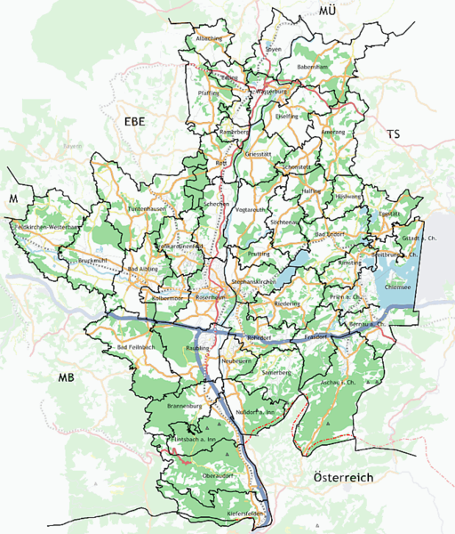
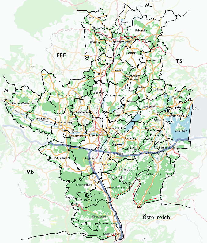
Osmarender map (zoom=10) from 2008-01-14 with borders extracted from an image at http://www.landkreis-rosenheim.de
![]()
Contains map data © OpenStreetMap contributors, made available under the terms of the Creative Commons Attribution-ShareAlike 2.0 (CC-BY-SA-2.0).
File history
Click on a date/time to view the file as it appeared at that time.
| Date/Time | Thumbnail | Dimensions | User | Comment | |
|---|---|---|---|---|---|
| current | 21:33, 31 March 2008 | | 676 × 792 (147 KB) | TrudeRO (talk | contribs) | Updated 2008-03-31 (rendered with Kosmos) |
| 12:24, 14 January 2008 | 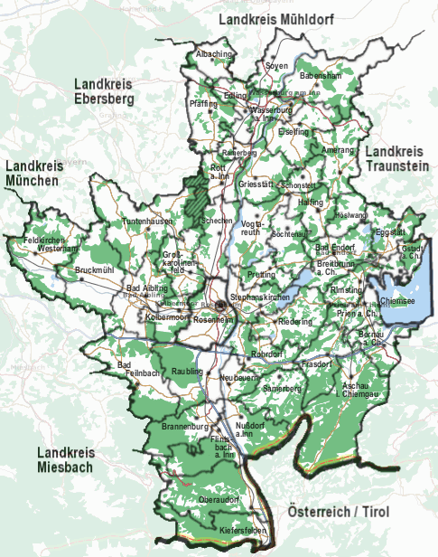 | 485 × 616 (108 KB) | TrudeRO (talk | contribs) | Osmarender map (zoom=10) from 2008-01-14 with borders extracted from an image at http://www.landkreis-rosenheim.de |
You cannot overwrite this file.
File usage
The following page uses this file: