File:Map budapest districts-and-neighbourhoods.svg
Jump to navigation
Jump to search


Size of this PNG preview of this SVG file: 629 × 599 pixels. Other resolutions: 252 × 240 pixels | 504 × 480 pixels | 806 × 768 pixels | 1,075 × 1,024 pixels | 738 × 703 pixels.
Original file (SVG file, nominally 738 × 703 pixels, file size: 171 KB)
This file and its description are from Wikimedia Commons.
Summary
| Description |
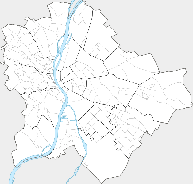
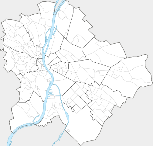
English: Map of Budapest with districts and neighbourhoods |
| Date | |
| Source | Own work |
| Author | Ludó |
Licensing
I, the copyright holder of this work, hereby publish it under the following license:
This file is licensed under the Creative Commons Attribution-Share Alike 4.0 International license.
- You are free:
- to share – to copy, distribute and transmit the work
- to remix – to adapt the work
- Under the following conditions:
- attribution – You must give appropriate credit, provide a link to the license, and indicate if changes were made. You may do so in any reasonable manner, but not in any way that suggests the licensor endorses you or your use.
- share alike – If you remix, transform, or build upon the material, you must distribute your contributions under the same or compatible license as the original.
File history
Click on a date/time to view the file as it appeared at that time.
| Date/Time | Thumbnail | Dimensions | User | Comment | |
|---|---|---|---|---|---|
| current | 11:49, 16 July 2017 | | 738 × 703 (171 KB) | wikimediacommons>Xing | Adding neighbourhoods of Kispest 1191: Northwest Kispest (historically known as Törökfalva) 1192: Wekerle Estate 1193: Northeast Kispest 1194: Residential Area 1195: Downtown 1196: Old City |
File usage
The following page uses this file: