File:Map dual carriageway junction2.png
Jump to navigation
Jump to search


No higher resolution available.
Map_dual_carriageway_junction2.png (300 × 300 pixels, file size: 3 KB, MIME type: image/png)
File history
Click on a date/time to view the file as it appeared at that time.
| Date/Time | Thumbnail | Dimensions | User | Comment | |
|---|---|---|---|---|---|
| current | 14:34, 22 January 2010 | | 300 × 300 (3 KB) | Calibrator (talk | contribs) | Reverted to version as of 17:47, 31 October 2007 |
| 14:33, 22 January 2010 |  | 300 × 300 (5 KB) | Calibrator (talk | contribs) | Reverted to version as of 07:22, 22 January 2010 | |
| 14:33, 22 January 2010 |  | 300 × 300 (5 KB) | Calibrator (talk | contribs) | Reverted to version as of 07:22, 22 January 2010 | |
| 07:24, 22 January 2010 |  | 300 × 300 (5 KB) | Calibrator (talk | contribs) | ||
| 07:22, 22 January 2010 |  | 300 × 300 (5 KB) | Calibrator (talk | contribs) | ||
| 07:09, 22 January 2010 |  | 300 × 300 (3 KB) | Calibrator (talk | contribs) | green line have tag oneway=no so it must not arrows | |
| 07:06, 22 January 2010 | 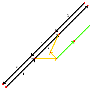 | 300 × 300 (3 KB) | Calibrator (talk | contribs) | green line have tag oneway=no so it must not arrows | |
| 17:47, 31 October 2007 |  | 300 × 300 (3 KB) | Etric Celine (talk | contribs) |
You cannot overwrite this file.
File usage
The following 11 pages use this file:
- Cs:Tag:highway=motorway link
- Ko:Tag:highway=motorway link
- Pl:Tag:highway=motorway link
- Pt:Tag:highway=motorway link
- Tag:highway=motorway link
- Uk:Tag:highway=motorway link
- Zh-hans:Tag:highway=motorway link
- FR:Tag:highway=motorway link
- ES:Tag:highway=motorway link
- IT:Tag:highway=motorway link
- JA:Tag:highway=motorway link