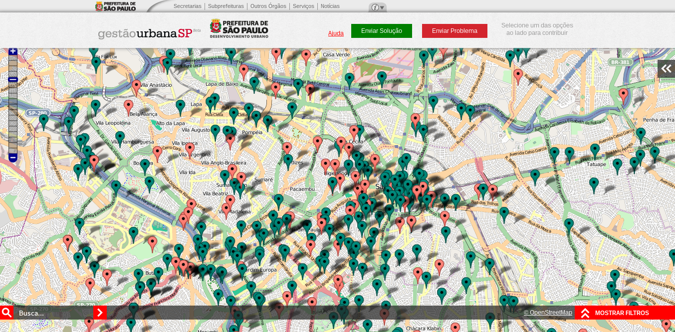
File:Mapeamento Colaborativo – Gestão Urbana SP 20130721-222059.png
Original file (1,353 × 666 pixels, file size: 987 KB, MIME type: image/png)
Summary
A project of the Brazilian biggest city São Paulo is using OpenStreetMap-based tiles as base map in its website. The project named “Mapeamento Colaborativo - Gestão Urbana SP” (Collaborative Mapping - Urban Management SP) allows the inhabitants to appoint problems and suggest solutions to the problems of the city. Link: http://mapa.gestaourbana.prefeitura.sp.gov.br/
Licensing
… of the base map (standard mapnik tiles from osm.org are used, e.g.) is: © OpenStreetMap contributors
![]()
![]()
![]()
Attribution not specified as a parameter! THIS LICENSE ALWAYS REQUIRES ATTRIBUTION! Use {{CC-BY-SA-2.0|Attribution, typically name of author}} See Template:CC-BY-SA-2.0 for full description how this template should be used.
Note, there is
{{CC-BY-SA-2.0 OpenStreetMap}} for files based on old OSM map data, before the license change made on 2012-09-12.There is also
{{OSM Carto screenshot||old_license}} for files based on old OSM map data, before the license change made on 2012-09-12, created using OSM Carto map style.
| Contains map data © OpenStreetMap contributors, made available under the terms of the Open Database License (ODbL).
The ODbL does not require any particular license for maps produced from ODbL data, produced maps may be subject also to other licences. |
… the remaining website parts possibly are not copyrighted/too small/too simple.
File history
Click on a date/time to view the file as it appeared at that time.
| Date/Time | Thumbnail | Dimensions | User | Comment | |
|---|---|---|---|---|---|
| current | 01:41, 22 July 2013 | | 1,353 × 666 (987 KB) | Wille (talk | contribs) | A project of the Brazilian biggest city is using the OpenStreetMap tiles in its website. The project named Mapeamento Colaborativo - Gestão Urbana SP (Collaborative Mapping - Urban Management SP) allows the São Paulo inhabitants to appoint problems a... |
You cannot overwrite this file.
File usage
There are no pages that use this file.