File:Mapillary road signs within iD.png
Jump to navigation
Jump to search


Size of this preview: 800 × 549 pixels. Other resolutions: 320 × 220 pixels | 640 × 440 pixels | 1,024 × 703 pixels | 1,188 × 816 pixels.
Original file (1,188 × 816 pixels, file size: 1.68 MB, MIME type: image/png)
Summary
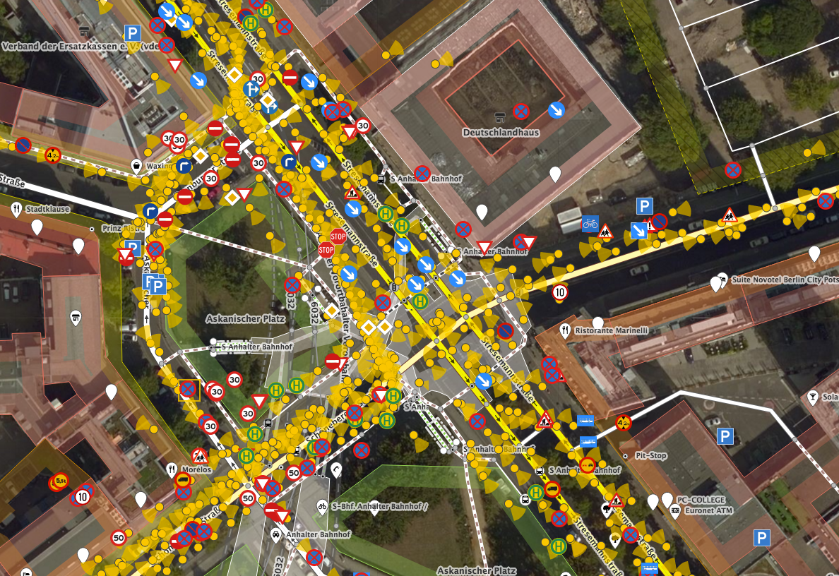
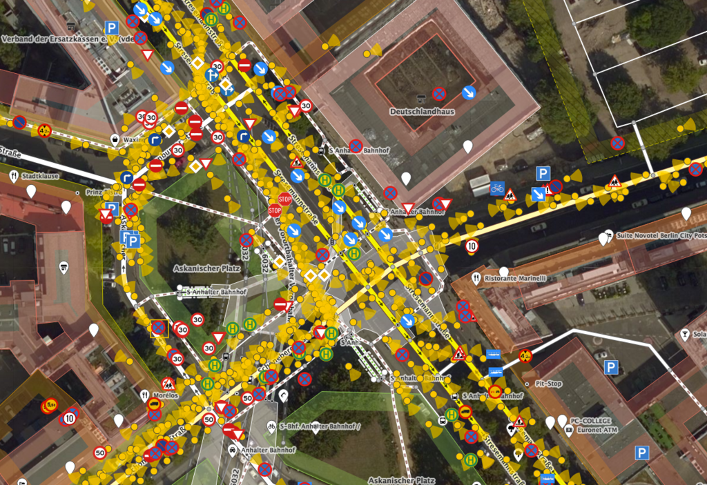
The iD editor showing data from Mapillary include new road signs detected in the street-level photos.
Screenshot viewing a junction in Berlin
Similar image was tweeted by Mapillary: https://twitter.com/mapillary/status/875392528756994049
This is a Featured image, which means that it has been identified as one of the best examples of OpenStreetMap mapping, or that it provides a useful illustration of the OpenStreetMap project. If you know another image of similar quality, you can nominate it on Featured image proposals.
Front-page image for week 25 of 2017 (19–25 Jun.).
- Image descriptions
- Deutsch : The iD editor showing a new data layer from Mapillary, with road signs detected within the street-level imagery.
- English : The iD editor showing a new data layer from Mapillary, with road signs detected within the street-level imagery.
- français : L’éditeur iD montrant une nouvelle couche de données de Mapillary, avec les panneaux de signalisation détectés dans l’imagerie au niveau du sol.
- italiano : L'editor iD può visualizzare un nuovo livello di dati da Mapillary che mostra i segnali rilevati nelle immagini a livello stradale.
- 中文(简体) : iD 编辑器显示来自 Mapillary 新的资料图层,能够用街景层级的图片侦测里面的道路方向指标。
- 中文(繁體) : iD 編輯器顯示來自 Mapillary 新的資料圖層,能夠用街景層級的圖片偵測裡面的道路方向指標。
Licensing
![]()
![]()
![]()
This work is licensed under the Creative Commons Attribution-ShareAlike 2.0 License.
Attribution not specified as a parameter! THIS LICENSE ALWAYS REQUIRES ATTRIBUTION! Use {{CC-BY-SA-2.0|Attribution, typically name of author}} See Template:CC-BY-SA-2.0 for full description how this template should be used.
Note, there is
There is also
Attribution not specified as a parameter! THIS LICENSE ALWAYS REQUIRES ATTRIBUTION! Use {{CC-BY-SA-2.0|Attribution, typically name of author}} See Template:CC-BY-SA-2.0 for full description how this template should be used.
Note, there is
{{CC-BY-SA-2.0 OpenStreetMap}} for files based on old OSM map data, before the license change made on 2012-09-12.There is also
{{OSM Carto screenshot||old_license}} for files based on old OSM map data, before the license change made on 2012-09-12, created using OSM Carto map style.
Only minor![]()
portions
Some minor portions of this image feature Bing aerial imagery.
Software screenshots and other illustrations of OpenStreetMap editing processes will often include some Bing imagery.
Bing imagery is not open licensed, but is generously made available to the OpenStreetMap project for deriving open licensed map data.
Such images in the OpenStreetMap wiki may be open licensed only where use of Bing is minor/incidental.
Bing imagery is not open licensed, but is generously made available to the OpenStreetMap project for deriving open licensed map data.
Such images in the OpenStreetMap wiki may be open licensed only where use of Bing is minor/incidental.
File history
Click on a date/time to view the file as it appeared at that time.
| Date/Time | Thumbnail | Dimensions | User | Comment | |
|---|---|---|---|---|---|
| current | 00:56, 19 June 2017 | | 1,188 × 816 (1.68 MB) | Harry Wood (talk | contribs) | The iD editor showing data from Mapillary include new road signs detected in the street-level photos. Screenshot viewing [https://www.openstreetmap.org/edit#map=19/52.50450/13.38261 a junction in Berlin] Similar image was tweeted by Mapillary... |
You cannot overwrite this file.
File usage
The following 14 pages use this file:
- Featured images/Apr-Jun 2017
- List of featured images/2017
- Pt:Featured images/Apr-Jun 2017
- Uk:Featured images/Apr-Jun 2017
- Zh-hans:Featured images/Apr-Jun 2017
- Zh-hant:Featured images/Apr-Jun 2017
- Template:Featured image d2
- Template:Iotw image/2017-25
- DE:Featured images/Apr-Jun 2017
- FR:Featured images/Apr-Jun 2017
- ES:Imágenes destacadas/Abr-Jun 2017
- IT:Featured images/Apr-Jun 2017
- RU:Featured images/Apr-Jun 2017
- JA:Featured images/Apr-Jun 2017