File:Mapping-Features-Parking-Lot.png
Jump to navigation
Jump to search

No higher resolution available.
Mapping-Features-Parking-Lot.png (384 × 384 pixels, file size: 112 KB, MIME type: image/png)
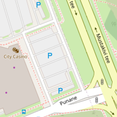
Screenshot of OSM Carto rendering of a parking lot, service streets and multiple parking aisles, surrounded by green space, roads and building.
Source: https://www.openstreetmap.org/#map=17/59.44050/24.86664
Licensing
![]()
![]()
This screenshot contains OpenStreetMap Carto rendering.
The OpenStreetMap Carto map style is made available under the Creative Commons CC-0 1.0 Universal Public Domain Dedication.
- Attribution to the map data:
| Contains map data © OpenStreetMap contributors, made available under the terms of the Open Database License (ODbL).
The ODbL does not require any particular license for maps produced from ODbL data, produced maps may be subject also to other licences. |
File history
Click on a date/time to view the file as it appeared at that time.
| Date/Time | Thumbnail | Dimensions | User | Comment | |
|---|---|---|---|---|---|
| current | 16:27, 28 January 2022 | | 384 × 384 (112 KB) | Chris2map (talk | contribs) | Update with new map section to match current map style. OSM Carto screenshot from https://www.openstreetmap.org/#map=17/59.44050/24.86664 |
| 07:02, 12 May 2009 | 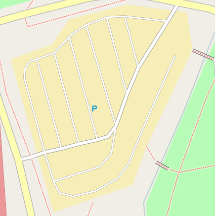 | 435 × 436 (43 KB) | UrSuS (talk | contribs) | ||
| 10:42, 6 February 2007 | 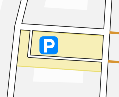 | 240 × 196 (11 KB) | Joto (talk | contribs) | Osmarender rendering of a parking lot with yellow area, service street and parking lot symbol. |
You cannot overwrite this file.
File usage
The following 53 pages use this file:
- Ca:Key:amenity
- Cs:Key:amenity
- Cs:Tag:highway=service
- Cs:Tag:service=parking aisle
- El:Key:amenity
- El:Tag:highway=service
- Et:Key:amenity
- Fa:Tag:highway=service
- Fi:Key:amenity
- Hr:Key:amenity
- Hu:Key:amenity
- Hu:Tag:highway=service
- Key:amenity
- Ko:Key:amenity
- Ko:Tag:highway=service
- Ms:Tag:highway=service
- No:Key:amenity
- Pl:Key:amenity
- Pl:Tag:highway=service
- Pt:Key:amenity
- Pt:Tag:highway=service
- Ro:Key:amenity
- Sk:Map Features
- Tag:highway=service
- Tag:service=parking aisle
- Tr:Key:amenity
- Uk:Key:amenity
- Uk:Tag:highway=service
- Zh-hans:Key:amenity
- Zh-hans:Tag:highway=service
- Zh-hans:Tag:service=parking aisle
- Zh-hant:Key:amenity
- Zh-hant:Tag:highway=service
- User:Geonick/Parking
- User:OnTour/Map Features
- User:Thomas Wood/Map Key
- Wiki:Files used by data items/3
- DE:Key:amenity
- FR:Key:amenity
- FR:Tag:highway=service
- ES:Key:amenity
- ES:Tag:highway=service
- ES:Tag:service=parking aisle
- IT:Key:amenity
- IT:Map Features/Essenziali
- IT:Tag:highway=service
- NL:Key:amenity
- RU:Key:amenity
- RU:Tag:highway=service
- RU:Tag:service=parking aisle
- JA:Key:amenity
- JA:Tag:highway=service
- JA:Tag:service=parking aisle