File:Mapping von Wegen.png
Jump to navigation
Jump to search

Size of this preview: 800 × 342 pixels. Other resolutions: 320 × 137 pixels | 640 × 274 pixels | 1,024 × 438 pixels | 1,280 × 547 pixels | 2,715 × 1,161 pixels.
Original file (2,715 × 1,161 pixels, file size: 369 KB, MIME type: image/png)
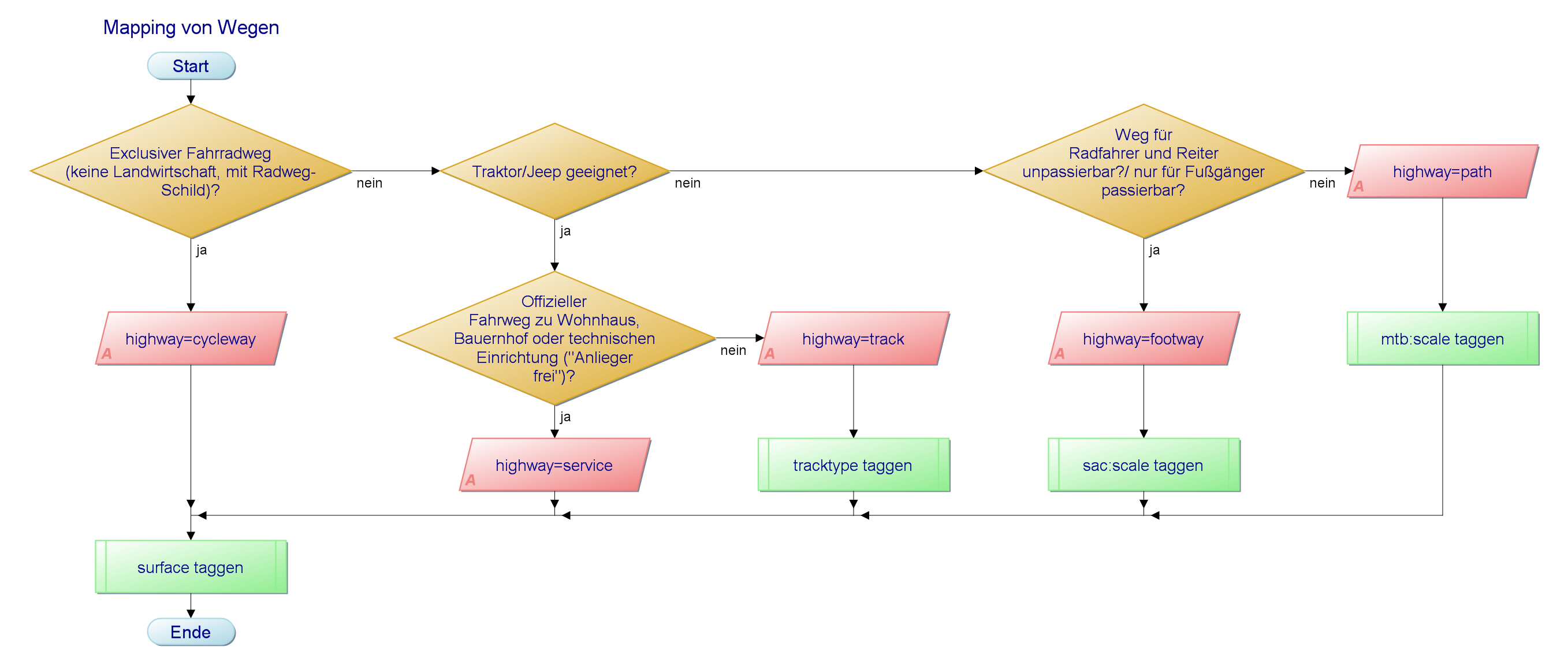
Mapping von Wegen Best Practice Mittelgebirge
File history
Click on a date/time to view the file as it appeared at that time.
| Date/Time | Thumbnail | Dimensions | User | Comment | |
|---|---|---|---|---|---|
| current | 08:22, 24 October 2012 | | 2,715 × 1,161 (369 KB) | Taunide (talk | contribs) | Mapping von Wegen Best Practice Mittelgebirge |
You cannot overwrite this file.
File usage
There are no pages that use this file.