File:Maps4BW Kartenausschnitt original.png
Jump to navigation
Jump to search


Size of this preview: 487 × 599 pixels. Other resolutions: 195 × 240 pixels | 621 × 764 pixels.
Original file (621 × 764 pixels, file size: 102 KB, MIME type: image/png)
Summary
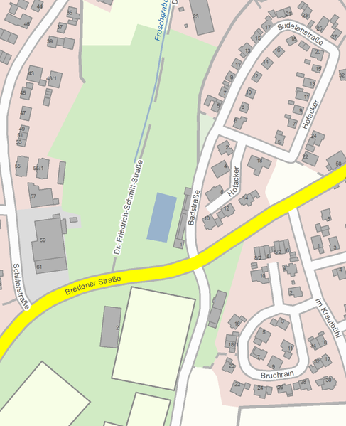
Beispielhafter Kartenausschnitt von Maps4BW in höchster Zoomstufe. Ort: Oberderdingen, Baden-Württemberg
Licensing
© Maps4BW, LGL, www.lgl-bw.de

The copyright holder of this file allows anyone to use it for any purpose, provided that the copyright holder is properly attributed. Redistribution, derivative work, commercial use, and all other use is permitted.
If you are the uploader, please provide proper attribution including source and name of author.
If you are the uploader, please provide proper attribution including source and name of author.
File history
Click on a date/time to view the file as it appeared at that time.
| Date/Time | Thumbnail | Dimensions | User | Comment | |
|---|---|---|---|---|---|
| current | 09:49, 16 February 2016 | | 621 × 764 (102 KB) | MarkusHD (talk | contribs) | Beispielhafter Kartenausschnitt von Maps4BW in höchster Zoomstufe Ort: Oberderdingen, Baden-Württemberg |
You cannot overwrite this file.
File usage
The following page uses this file: