File:Marker Innstraße 33 Passau.png
Jump to navigation
Jump to search

No higher resolution available.
Marker_Innstraße_33_Passau.png (245 × 245 pixels, file size: 61 KB, MIME type: image/png)
Summary
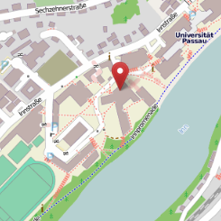
http://www.openstreetmap.org/?mlat=48.56702&mlon=13.45154&zoom=16&layers=M
OpenStreetMap-Karte mit Marker auf dem Gebäude "Informatik und Mathematik" der Universität Passau.
Licensing
| Contains map data © OpenStreetMap contributors, made available under the terms of the Open Database License (ODbL).
The ODbL does not require any particular license for maps produced from ODbL data, produced maps may be subject also to other licences. |
File history
Click on a date/time to view the file as it appeared at that time.
| Date/Time | Thumbnail | Dimensions | User | Comment | |
|---|---|---|---|---|---|
| current | 15:05, 29 November 2012 | | 245 × 245 (61 KB) | Tordanik (talk | contribs) | http://www.openstreetmap.org/?mlat=48.56702&mlon=13.45154&zoom=16&layers=M OpenStreetMap-Karte mit Marker auf dem Gebäude "Informatik und Mathematik" der Universität Passau. |
You cannot overwrite this file.
File usage
The following 2 pages use this file: