File:Meerestiefen Europa.jpg
Jump to navigation
Jump to search

Size of this preview: 479 × 599 pixels. Other resolutions: 192 × 240 pixels | 384 × 480 pixels | 687 × 859 pixels.
Original file (687 × 859 pixels, file size: 428 KB, MIME type: image/jpeg)
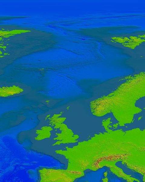
Bathymetrische Berechnung von Tobias Wendorff
File history
Click on a date/time to view the file as it appeared at that time.
| Date/Time | Thumbnail | Dimensions | User | Comment | |
|---|---|---|---|---|---|
| current | 01:27, 2 November 2009 | | 687 × 859 (428 KB) | Markus B (talk | contribs) | Bathymetrische Berechnung von Tobias Wendorff |
You cannot overwrite this file.
File usage
The following page uses this file: