File:Missouri-TigerEdits-Sept292009.png
Jump to navigation
Jump to search
Size of this preview: 800 × 573 pixels. Other resolutions: 320 × 229 pixels | 640 × 458 pixels | 1,024 × 734 pixels | 1,410 × 1,010 pixels.
Original file (1,410 × 1,010 pixels, file size: 1.49 MB, MIME type: image/png)
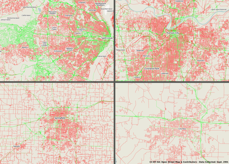
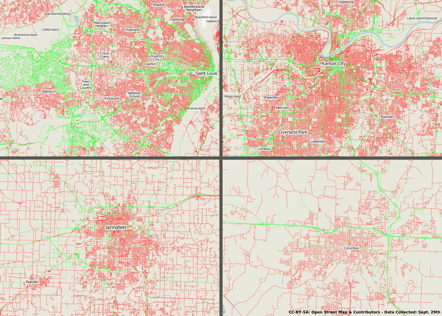
The four largest urban areas of Missouri and their relative TIGER edit level, Saint Louis (largest urban area), Kansas City (2nd), Springfield (3rd), and Columbia (4th). Data collected on Sept. 29, 2009 11:00 PM Central Time.
File history
Click on a date/time to view the file as it appeared at that time.
| Date/Time | Thumbnail | Dimensions | User | Comment | |
|---|---|---|---|---|---|
| current | 04:00, 30 September 2009 | | 1,410 × 1,010 (1.49 MB) | AustinMartin (talk | contribs) | The four largest urban areas of Missouri and their relative TIGER edit level, Saint Louis (largest urban area), Kansas City (2nd), Springfield (3rd), and Columbia (4th). Data collected on Sept. 29, 2009 11:00 PM Central Time. |
You cannot overwrite this file.
File usage
The following 2 pages use this file: