File:Mount Samat Shrine in F4 Map.jpg
Jump to navigation
Jump to search

No higher resolution available.
Mount_Samat_Shrine_in_F4_Map.jpg (542 × 549 pixels, file size: 62 KB, MIME type: image/jpeg)
Information
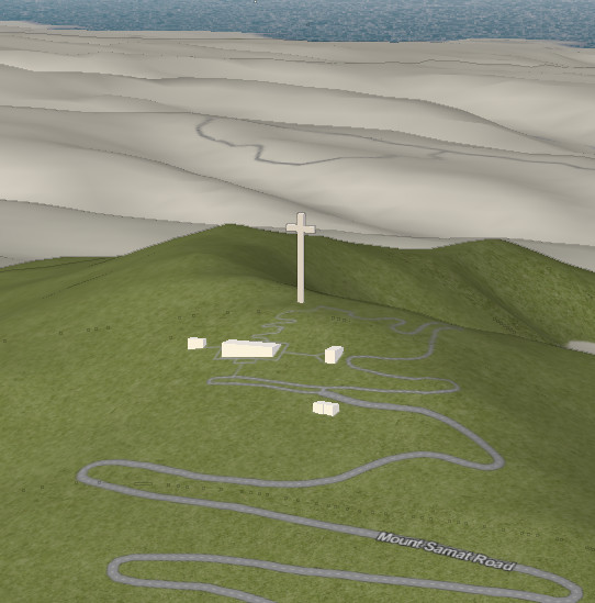
| Description | A view of Mount Samat National Shrine on the F4 Map showing 3-D building data and SRTM-based elevation data. |
|---|---|
| Author | Screenshot by seav |
| Source | http://map.f4-group.com/#elevations.enabled=true&lat=14.6055438&lon=120.5084025&zoom=17&camera.theta=80&camera.phi=114.017 |
| Date | 2013-10-06 |
| Permission | Fair use (no information on the license of the F4 Map) |
| Contains map data © OpenStreetMap contributors, made available under the terms of the Open Database License (ODbL).
The ODbL does not require any particular license for maps produced from ODbL data, produced maps may be subject also to other licences. |
File history
Click on a date/time to view the file as it appeared at that time.
| Date/Time | Thumbnail | Dimensions | User | Comment | |
|---|---|---|---|---|---|
| current | 22:26, 6 October 2013 | | 542 × 549 (62 KB) | Seav (talk | contribs) | ==Information== {{Information |Description = A view of Mount Samat National Shrine on the F4 Map showing 3-D building data and SRTM-based elevation data. |Source = http://map.f4-group.com/#elevations.enabled=true&lat=14.6055438&lon=1... |
You cannot overwrite this file.
File usage
The following page uses this file: