File:NOAA 2010-01-18.png
Jump to navigation
Jump to search

No higher resolution available.
NOAA_2010-01-18.png (685 × 192 pixels, file size: 58 KB, MIME type: image/png)
File history
Click on a date/time to view the file as it appeared at that time.
| Date/Time | Thumbnail | Dimensions | User | Comment | |
|---|---|---|---|---|---|
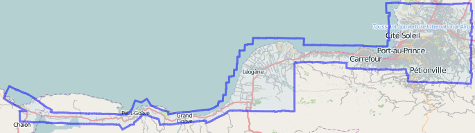
| current | 23:29, 10 February 2010 | 685 × 192 (58 KB) | Ceyockey (talk | contribs) | Screen shot showing extent of relation 405749 depicted in the main map viewer. This relation was drawn around the full extent of NOAA imagery provided for use in OSM's response to the Haiti earthquake. URL for screenshot: http://www.openstreetmap.org/?r | |
| 07:20, 19 January 2010 |  | 982 × 684 (491 KB) | Jcollie (talk | contribs) |
You cannot overwrite this file.
File usage
The following 2 pages use this file: