File:Noname se london.jpg
Jump to navigation
Jump to search

No higher resolution available.
Noname_se_london.jpg (500 × 395 pixels, file size: 69 KB, MIME type: image/jpeg)
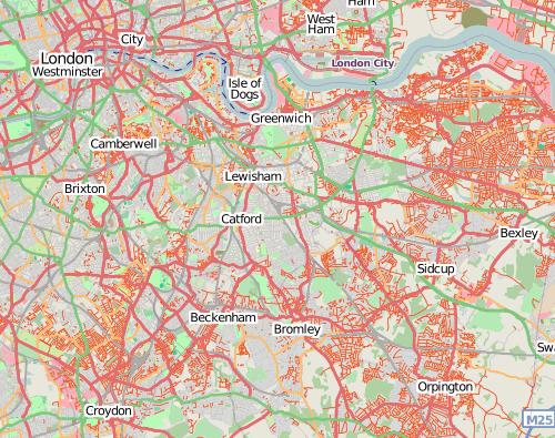
The NoName map layer helps identify areas where large numbers of road names are missing, such as these areas in South East London.
License
![]()
Contains map data © OpenStreetMap contributors, made available under the terms of the Creative Commons Attribution-ShareAlike 2.0 (CC-BY-SA-2.0).
This image is exclusively featuring CloudMade's rendering of OpenStreetMap (in the "NoName" style. One of many tile sets CloudMade used to host) which were cc-by-sa-2.0 licensed.
File history
Click on a date/time to view the file as it appeared at that time.
| Date/Time | Thumbnail | Dimensions | User | Comment | |
|---|---|---|---|---|---|
| current | 13:55, 29 September 2008 | | 500 × 395 (69 KB) | Daveemtb (talk | contribs) | The NoName map layer helps identify areas where large numbers of road names are missing, such as these areas in South East London. |
You cannot overwrite this file.
File usage
The following 3 pages use this file: