File:Nottingham gps traces ex osm 20110105.png
Jump to navigation
Jump to search
Size of this preview: 620 × 600 pixels. Other resolutions: 248 × 240 pixels | 496 × 480 pixels | 732 × 708 pixels.
Original file (732 × 708 pixels, file size: 97 KB, MIME type: image/png)
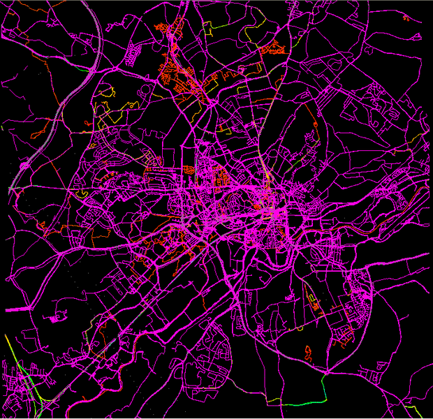
GPS traces covering the greater Nottingham area as stored in the OSM Planet on 2011-01-05. The traces provide an idea of how much of the city has been mapped by ground survey (although not every mapper chooses to upload traces). Additional traces in poorly covered areas are of value for all OSM contributors.
File history
Click on a date/time to view the file as it appeared at that time.
| Date/Time | Thumbnail | Dimensions | User | Comment | |
|---|---|---|---|---|---|
| current | 14:22, 5 January 2011 | | 732 × 708 (97 KB) | SK53 (talk | contribs) | GPS traces covering the greater Nottingham area as stored in the OSM Planet on 2011-01-05. The traces provide an idea of how much of the city has been mapped by ground survey (although not every mapper chooses to upload traces). Additional traces in poorl |
You cannot overwrite this file.
File usage
The following page uses this file: