File:OSM-node-density-map-UHD-crop-2014.png
Jump to navigation
Jump to search

No higher resolution available.
OSM-node-density-map-UHD-crop-2014.png (726 × 352 pixels, file size: 546 KB, MIME type: image/png)
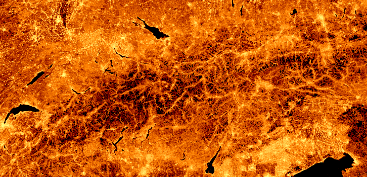
OpenStreetMap node density as of June 2014. Each pixel represents one tile at zoom-level 15.
Licensing
Image available under the terms of the Creative Commons Attribution 3.0 Unported license (CC-BY 3.0).
Based on data © OpenStreetMap (ODbL).
![]()
![]()
This work is licensed under the Creative Commons Attribution 3.0 License.
Attribution not specified as a parameter! THIS LICENSE ALWAYS REQUIRES ATTRIBUTION! Use {{CC-BY-3.0|Attribution, typically name of author}} See Template:CC-BY-3.0 for full description how this template should be used.
Attribution not specified as a parameter! THIS LICENSE ALWAYS REQUIRES ATTRIBUTION! Use {{CC-BY-3.0|Attribution, typically name of author}} See Template:CC-BY-3.0 for full description how this template should be used.
| Contains map data © OpenStreetMap contributors, made available under the terms of the Open Database License (ODbL).
The ODbL does not require any particular license for maps produced from ODbL data, produced maps may be subject also to other licences. |
see also
- Error creating thumbnail: File with dimensions greater than 125 MP


File history
Click on a date/time to view the file as it appeared at that time.
| Date/Time | Thumbnail | Dimensions | User | Comment | |
|---|---|---|---|---|---|
| current | 09:17, 27 June 2014 | | 726 × 352 (546 KB) | Tyr (talk | contribs) |
You cannot overwrite this file.
File usage
The following 5 pages use this file: