File:OSM Map of NTU.png
Jump to navigation
Jump to search


Size of this preview: 742 × 599 pixels. Other resolutions: 297 × 240 pixels | 594 × 480 pixels | 946 × 764 pixels.
Original file (946 × 764 pixels, file size: 236 KB, MIME type: image/png)
Summary
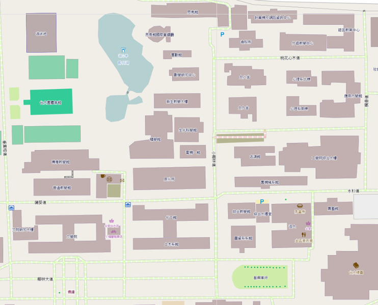
The OSM map drew by Supaplex on NTU Mapping Party.
Licensing
![]()
![]()
This screenshot contains OpenStreetMap Carto rendering.
The OpenStreetMap Carto map style is made available under the Creative Commons CC-0 1.0 Universal Public Domain Dedication.
- Attribution to the map data:
| Contains map data © OpenStreetMap contributors, made available under the terms of the Open Database License (ODbL).
The ODbL does not require any particular license for maps produced from ODbL data, produced maps may be subject also to other licences. |
File history
Click on a date/time to view the file as it appeared at that time.
| Date/Time | Thumbnail | Dimensions | User | Comment | |
|---|---|---|---|---|---|
| current | 15:26, 6 March 2013 | | 946 × 764 (236 KB) | Supaplex (talk | contribs) | More accurate map of NTU |
| 09:25, 19 November 2012 |  | 976 × 537 (111 KB) | Supaplex (talk | contribs) | The OSM map drew by Supaplex on NTU Mapping Party. |
You cannot overwrite this file.
File usage
The following page uses this file: