File:OSM cross kitchen.jpg
Original file (900 × 773 pixels, file size: 198 KB, MIME type: image/jpeg)
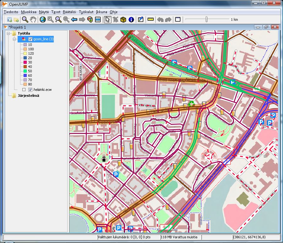
Image combined from a georeferenced basemap of Helsinki in ECW format and in UTM N35 projection and a vector layer from OGC Web Feature Service serving the same data. Data was imported first into PostGIS database with osm2pgsql utility. Basemap was rendered with Mapnik and nik2img.py utility into one georeferenced 10000 by 10000 pixel sized image covering most of Helsinki with 2.5 meter pixel size. File size after conversion to ECW format with gdal_translate program is roughly 25 megabytes. Vector overlay comes from GeoServer WFS service. All lines with some highway tag, except highway=cycleway and highway=footway have been fetched from the service. Image and vectors have been combined with OpenJUMP GIS program and highways have been classified by their maxspeed tags. Resulting map visualises the maxspeed values, but it works also as a quality control tool by showing the ways which don't have any maxspeed tag yet with dashed red line.
File history
Click on a date/time to view the file as it appeared at that time.
| Date/Time | Thumbnail | Dimensions | User | Comment | |
|---|---|---|---|---|---|
| current | 13:19, 16 November 2008 | | 900 × 773 (198 KB) | JRA (talk | contribs) | Image combined from a georeferenced basemap of Helsinki in ECW format and in UTM N35 projection and a vector layer from OGC Web Feature Service serving the same data. Data was imported first into PostGIS database with osm2pgsql utility. Basemap was rende |
You cannot overwrite this file.
File usage
There are no pages that use this file.