File:Oakham labelled.png
Jump to navigation
Jump to search


Size of this preview: 540 × 600 pixels. Other resolutions: 216 × 240 pixels | 432 × 480 pixels | 691 × 768 pixels | 922 × 1,024 pixels | 1,782 × 1,980 pixels.
Original file (1,782 × 1,980 pixels, file size: 1,007 KB, MIME type: image/png)
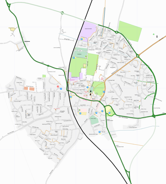
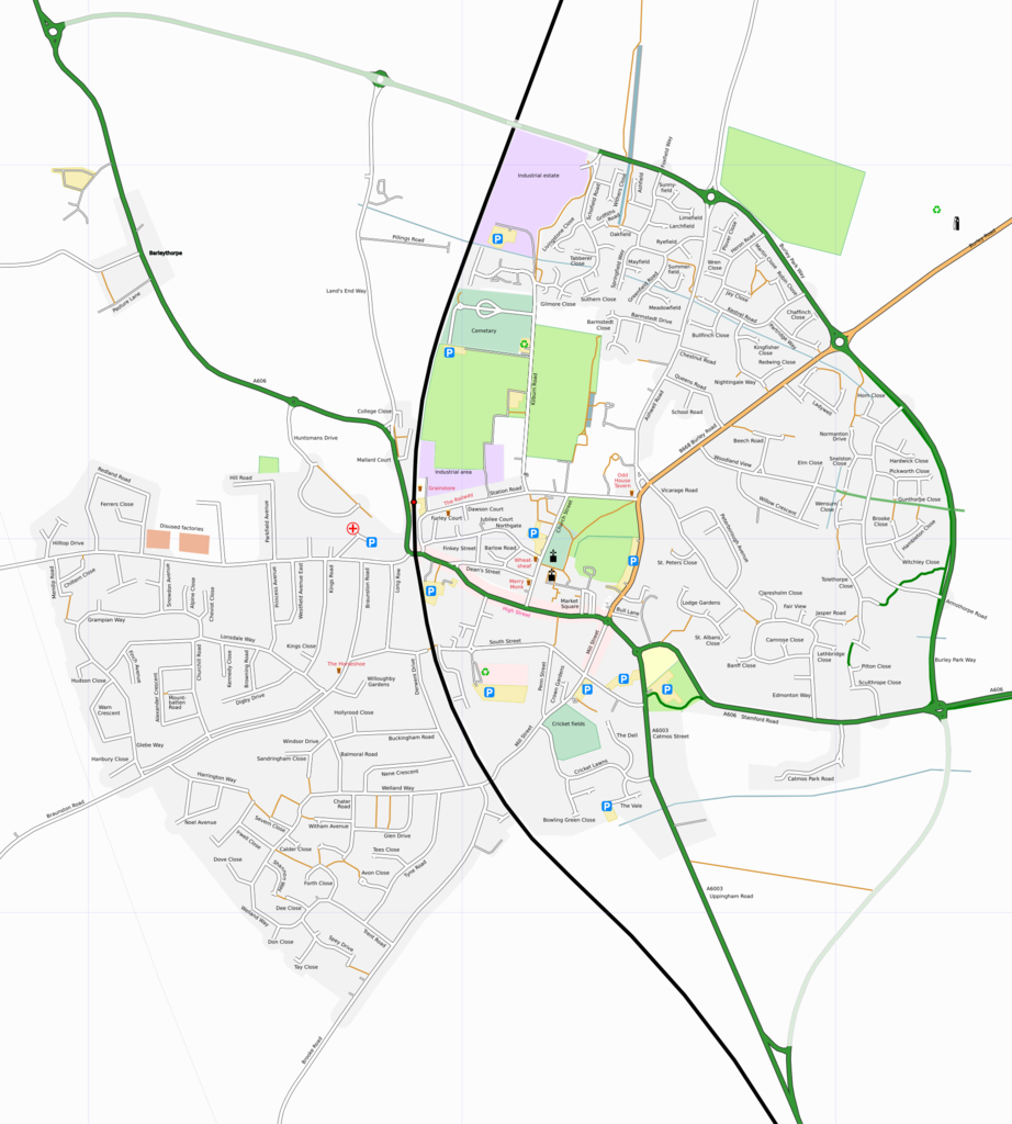
Map of Oakham
This map and others like it, were created by OpenStreetmap contributors, and are licensed as Creative Commons CC-BY-SA 2.0 (https://creativecommons.org/licenses/by-sa/2.0/) (see OpenStreetMap licence).
Use {{mapof|PlaceName}} to add this template to your images.
This map and others like it, were created by OpenStreetmap contributors, and are licensed as Creative Commons CC-BY-SA 2.0 (https://creativecommons.org/licenses/by-sa/2.0/) (see OpenStreetMap licence).
Use {{mapof|PlaceName}} to add this template to your images.
Vector data file:
http://svn.openstreetmap.org/maps/uk/towns/oakham/oakham.svg
This is a Featured image, which means that it has been identified as one of the best examples of OpenStreetMap mapping, or that it provides a useful illustration of the OpenStreetMap project. If you know another image of similar quality, you can nominate it on Featured image proposals.
Front-page image on 21 Oct 2006
File history
Click on a date/time to view the file as it appeared at that time.
| Date/Time | Thumbnail | Dimensions | User | Comment | |
|---|---|---|---|---|---|
| current | 22:27, 20 October 2006 | | 1,782 × 1,980 (1,007 KB) | Ojw (talk | contribs) | label some of the yellow "landuse=parking" areas |
| 22:10, 20 October 2006 |  | 1,782 × 1,980 (1,007 KB) | Ojw (talk | contribs) | fix canal put it below roads | |
| 21:38, 20 October 2006 | 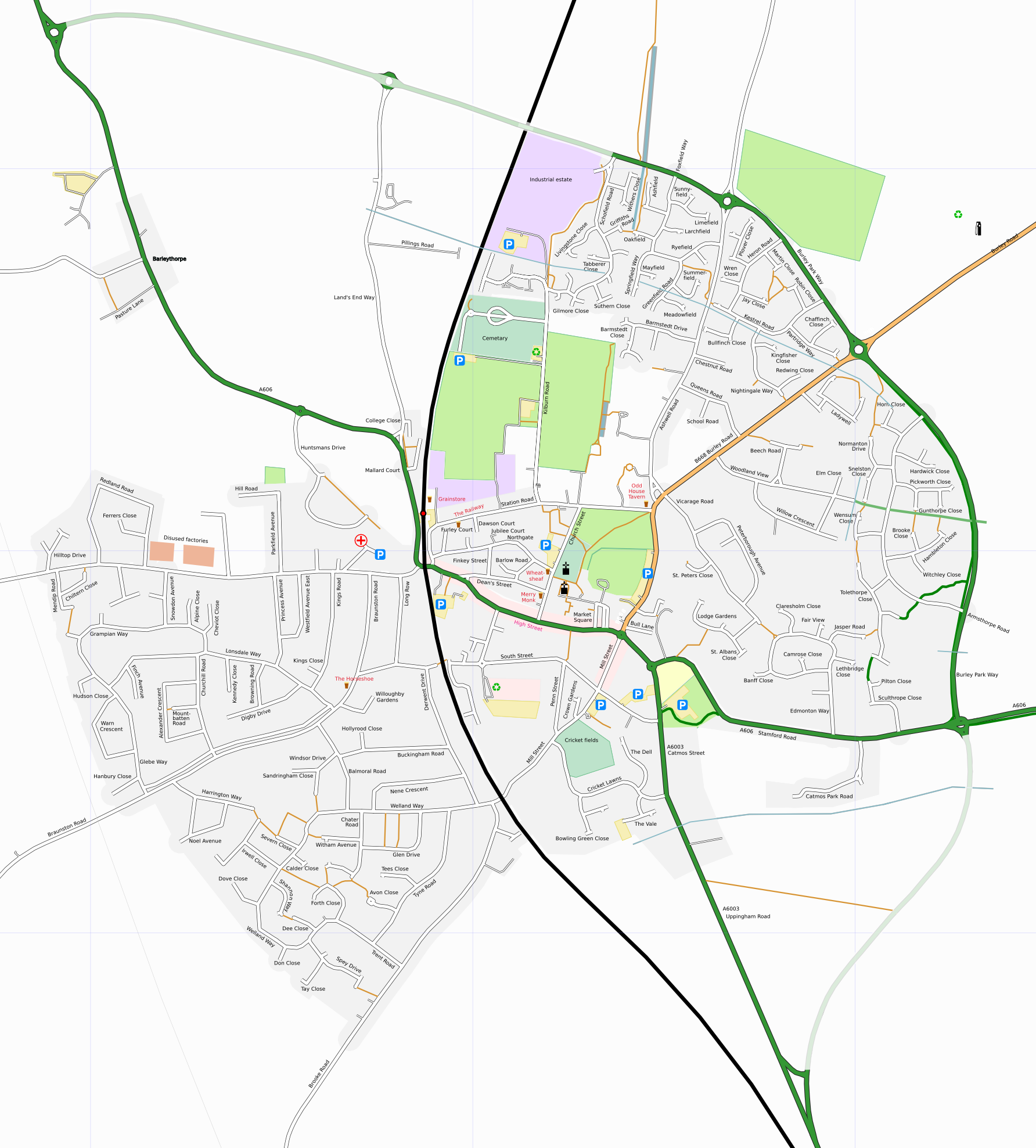 | 1,784 × 1,977 (1,006 KB) | Ojw (talk | contribs) | bypass finish + label disused factories | |
| 20:55, 20 October 2006 |  | 1,782 × 1,978 (1,005 KB) | Ojw (talk | contribs) | ||
| 20:06, 20 October 2006 | 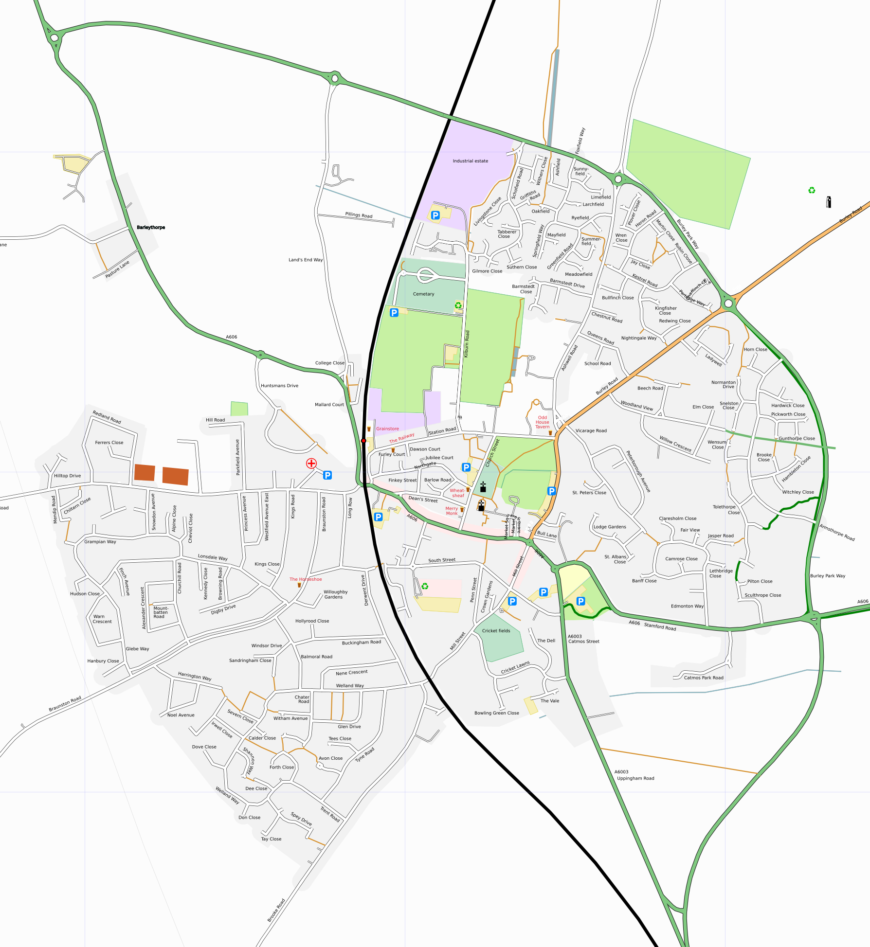 | 1,788 × 1,947 (987 KB) | Ojw (talk | contribs) | {{mapof|Oakham}} |
You cannot overwrite this file.
File usage
The following file is a duplicate of this file (more details):
- File:Oakham labelled.png from Wikimedia Commons
The following 4 pages use this file: