File:Osm-defining-the-inside-of-an-area-by-coding-solely-if-it-lies-to-the-left-or-right-of-a-way.svg
Jump to navigation
Jump to search

Size of this PNG preview of this SVG file: 800 × 566 pixels. Other resolutions: 320 × 226 pixels | 640 × 453 pixels | 1,024 × 724 pixels | 1,280 × 905 pixels | 1,052 × 744 pixels.
Original file (SVG file, nominally 1,052 × 744 pixels, file size: 74 KB)
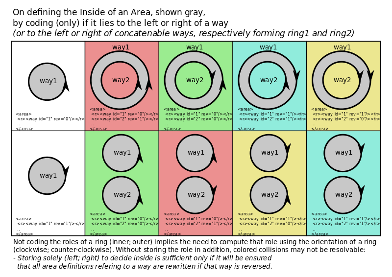
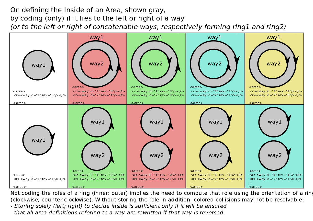
There is an extended version, that additionally visualizes the implications of reversing a way (the way itself, not the rev-flag) without updating area definitions that depend on it:

Licensing
![]()
I, the creator of this work, hereby release it into the public domain. This applies worldwide.
In case this is not legally possible, I grant anyone the right to use this work for any purpose, without any conditions, unless such conditions are required by law.
Notice to creator or uploader: Please consider using {{CC0-self}} instead for your work.
"Releasing work to public domain" has some issues, as it is not well defined in some jurisdictions and/or it is not actually possible to "release to public domain". Using CC0 license achieves the intended effect while avoiding such problems and is well suited for media files.
File history
Click on a date/time to view the file as it appeared at that time.
| Date/Time | Thumbnail | Dimensions | User | Comment | |
|---|---|---|---|---|---|
| current | 16:44, 9 January 2016 | | 1,052 × 744 (74 KB) | Cmuelle8 (talk | contribs) | synchronize text descriptions above and below table to the updated ones in Osm-defining-the-inside-of-an-area-by-coding-solely-if-it-lies-to-the-left-or-right-of-a-way_extended.svg |
| 18:48, 8 January 2016 |  | 1,052 × 744 (73 KB) | Cmuelle8 (talk | contribs) | corrected markup | |
| 17:49, 7 January 2016 |  | 1,052 × 744 (72 KB) | Cmuelle8 (talk | contribs) |
You cannot overwrite this file.
File usage
The following page uses this file: