File:Osm-world-coastlines-with-graticule-test-image.png
Jump to navigation
Jump to search


Size of this preview: 800 × 400 pixels. Other resolutions: 320 × 160 pixels | 640 × 320 pixels | 1,024 × 512 pixels | 1,280 × 639 pixels | 3,081 × 1,539 pixels.
Original file (3,081 × 1,539 pixels, file size: 134 KB, MIME type: image/png)
Summary
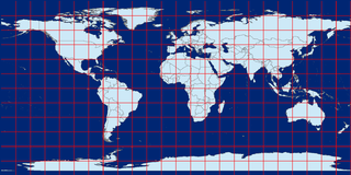
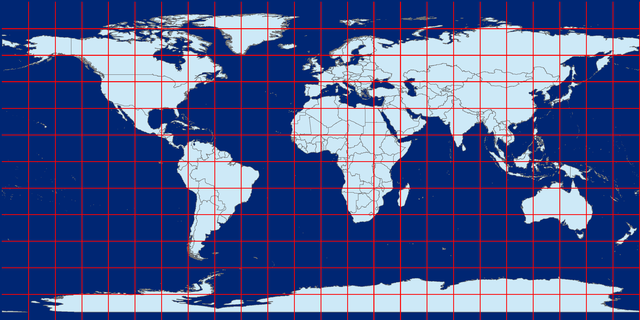
Example test image, the OSM coastline processed data in equirectangular (plat caree) projection and 15 degree graticules.
Data courtesy of the Coastline error checker http://wiki.openstreetmap.org/wiki/Coastline_error_checker#Current_Location
Note that the gap at the bottom is due to the Mercator projection not allowing latitudes beyond 80-something degrees south. You don't see the same gap at the north pole as there's no land there ;-)
Licensing
![]()
![]()
![]()
This work is licensed under the Creative Commons Attribution-ShareAlike 2.0 License.
Attribution not specified as a parameter! THIS LICENSE ALWAYS REQUIRES ATTRIBUTION! Use {{CC-BY-SA-2.0|Attribution, typically name of author}} See Template:CC-BY-SA-2.0 for full description how this template should be used.
Note, there is
There is also
Attribution not specified as a parameter! THIS LICENSE ALWAYS REQUIRES ATTRIBUTION! Use {{CC-BY-SA-2.0|Attribution, typically name of author}} See Template:CC-BY-SA-2.0 for full description how this template should be used.
Note, there is
{{CC-BY-SA-2.0 OpenStreetMap}} for files based on old OSM map data, before the license change made on 2012-09-12.There is also
{{OSM Carto screenshot||old_license}} for files based on old OSM map data, before the license change made on 2012-09-12, created using OSM Carto map style.
File history
Click on a date/time to view the file as it appeared at that time.
| Date/Time | Thumbnail | Dimensions | User | Comment | |
|---|---|---|---|---|---|
| current | 19:59, 14 August 2012 | | 3,081 × 1,539 (134 KB) | Stevefaeembra (talk | contribs) | Example test image, the OSM coastline processed data in equirectangular (plat caree) projection and 15 degree graticules. Data courtesy of the Coastline error checker http://wiki.openstreetmap.org/wiki/Coastline_error_checker#Current_Location |
You cannot overwrite this file.
File usage
The following page uses this file: