File:Osmand Hektometertafel-110-8b.png
Jump to navigation
Jump to search

Size of this preview: 800 × 450 pixels. Other resolutions: 320 × 180 pixels | 640 × 360 pixels | 1,280 × 720 pixels.
Original file (1,280 × 720 pixels, file size: 373 KB, MIME type: image/png)
Summary
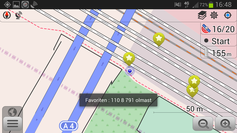
Anzeige einer erfassten Hektometertafel in Osmand. Die als GPX-Punkt ("Favorit") erfasste Tafel liegt auf einer Bahnstrecke, wenige Meter neben dem Mapper.
Der Text ist eine vom Mapper verwendete Kurzform. Sie steht für eine Hektometertafel mit Hundert-Meter-Wert "110,8", einem metergenauen Wert von "110,791", die an einem Oberleitungamsten ("olmast") hängt.
Licensing
![]()
![]()
![]()
This work is licensed under the Creative Commons Attribution-ShareAlike 2.0 License.
Attribution not specified as a parameter! THIS LICENSE ALWAYS REQUIRES ATTRIBUTION! Use {{CC-BY-SA-2.0|Attribution, typically name of author}} See Template:CC-BY-SA-2.0 for full description how this template should be used.
Note, there is
There is also
Attribution not specified as a parameter! THIS LICENSE ALWAYS REQUIRES ATTRIBUTION! Use {{CC-BY-SA-2.0|Attribution, typically name of author}} See Template:CC-BY-SA-2.0 for full description how this template should be used.
Note, there is
{{CC-BY-SA-2.0 OpenStreetMap}} for files based on old OSM map data, before the license change made on 2012-09-12.There is also
{{OSM Carto screenshot||old_license}} for files based on old OSM map data, before the license change made on 2012-09-12, created using OSM Carto map style.
File history
Click on a date/time to view the file as it appeared at that time.
| Date/Time | Thumbnail | Dimensions | User | Comment | |
|---|---|---|---|---|---|
| current | 21:20, 1 May 2014 | | 1,280 × 720 (373 KB) | Bigbug21 (talk | contribs) | Anzeige einer erfassten Hektometertafel in Osmand. Die als GPX-Punkt ("Favorit") erfasste Tafel liegt auf einer Bahnstrecke, wenige Meter neben dem Mapper. Der Text ist eine vom Mapper verwendete Kurzform. Sie steht für eine Hektometertafel mit H... |
You cannot overwrite this file.
File usage
There are no pages that use this file.