File:Osmapa.pl-rendering.png

Original file (1,452 × 707 pixels, file size: 328 KB, MIME type: image/png)
Summary
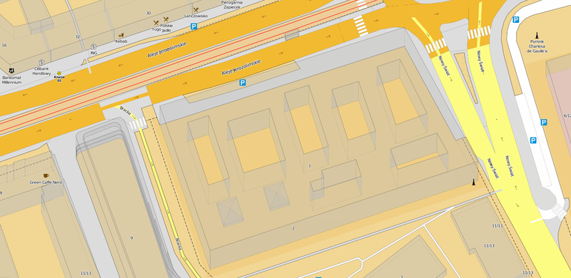
Screenshot of the osmapa.pl OSM mapnik stylesheet with pseudo-3D buildings. The stylesheet is maintained at https://github.com/balrog-kun/OSMapa-Topo and was probably one of the first Topographic maps made with OSM (2011), with contours, colored hiking trails, etc. The colour scheme is based on 20th century paper maps of Eastern Europe. Higher zoom levels don't resemble topograhic maps anymore, but were used for trialling some advanced rendering ideas some of which have been later also used by more popular stylesheets.
Licensing
| Contains map data © OpenStreetMap contributors, made available under the terms of the Open Database License (ODbL).
The ODbL does not require any particular license for maps produced from ODbL data, produced maps may be subject also to other licences. |
File history
Click on a date/time to view the file as it appeared at that time.
| Date/Time | Thumbnail | Dimensions | User | Comment | |
|---|---|---|---|---|---|
| current | 21:45, 13 October 2015 | | 1,452 × 707 (328 KB) | Balrog (talk | contribs) | Screenshot of the osmapa.pl OSM mapnik stylesheet with pseudo-3D buildings. The stylesheet is maintained at https://github.com/balrog-kun/OSMapa-Topo and was probably one of the first Topographic maps made with OSM (2011), with contours, colored hikin... |
You cannot overwrite this file.
File usage
The following 3 pages use this file: