File:Otm-peru-höhenlinien.png
Jump to navigation
Jump to search

Size of this preview: 800 × 450 pixels. Other resolutions: 320 × 180 pixels | 640 × 360 pixels | 1,024 × 576 pixels | 1,280 × 720 pixels | 1,844 × 1,037 pixels.
Original file (1,844 × 1,037 pixels, file size: 1.78 MB, MIME type: image/png)
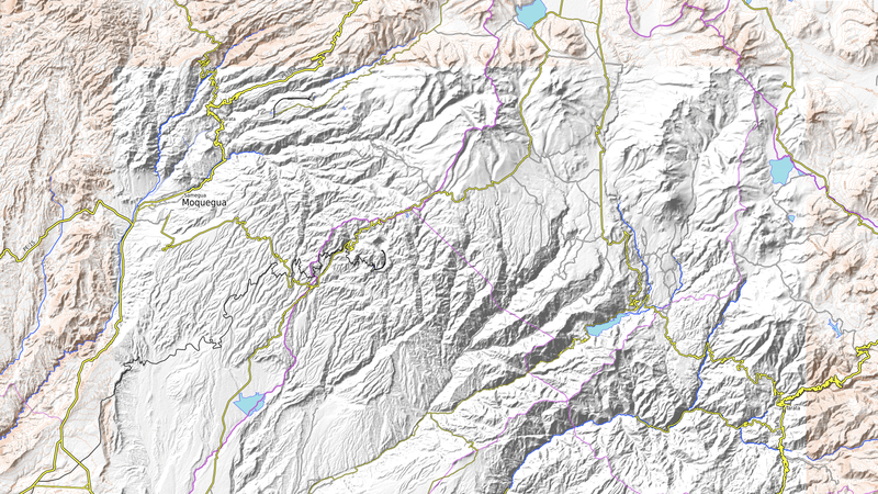
Bei OpenTopoMap fehlen hier die Höhenlinien.
File history
Click on a date/time to view the file as it appeared at that time.
| Date/Time | Thumbnail | Dimensions | User | Comment | |
|---|---|---|---|---|---|
| current | 07:11, 7 August 2016 | | 1,844 × 1,037 (1.78 MB) | Kopiersperre (talk | contribs) | Bei OpenTopoMap fehlen [https://opentopomap.org/#map=11/-17.2494/-70.5302 hier] die Höhenlinien. |
You cannot overwrite this file.
File usage
There are no pages that use this file.