File:Oxford Steet Cake Diagram.png
Jump to navigation
Jump to search


Size of this preview: 800 × 593 pixels. Other resolutions: 320 × 237 pixels | 640 × 474 pixels | 919 × 681 pixels.
Original file (919 × 681 pixels, file size: 416 KB, MIME type: image/png)
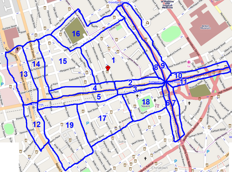
cake diagram for London/Summer 2009 Mapping Party Marathon Oxford Street
- Slice choices
- Harry Wood - Slice 7. Charing X Rd East incl off-cake down to leicester sq tube
- Firefishy - Slice 4 ended up doing 2345!
- Matt - Slice 8. TCR West. With help from Emma ended up doing a bit of 9 too
- Ollie - Slice 16
- Randomjunk - Slice 17
- Smsm1
- JennyH - Slice 3
File history
Click on a date/time to view the file as it appeared at that time.
| Date/Time | Thumbnail | Dimensions | User | Comment | |
|---|---|---|---|---|---|
| current | 00:33, 21 April 2009 | | 919 × 681 (416 KB) | Harry Wood (talk | contribs) | cake diagram for London/Summer 2009 Mapping Party Marathon Oxford Street |
You cannot overwrite this file.
File usage
There are no pages that use this file.