File:Paris 1st map.png
Jump to navigation
Jump to search


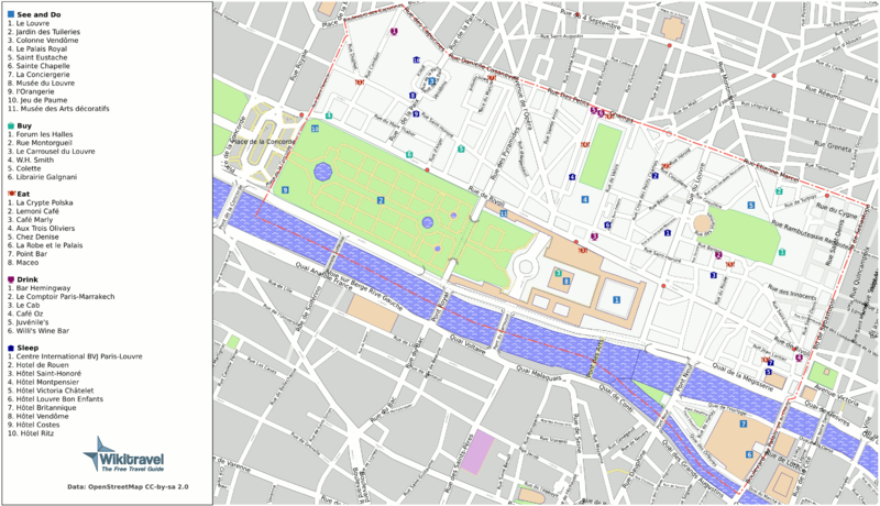
Size of this preview: 800 × 460 pixels. Other resolutions: 320 × 184 pixels | 640 × 368 pixels | 1,024 × 589 pixels | 1,280 × 736 pixels | 3,008 × 1,730 pixels.
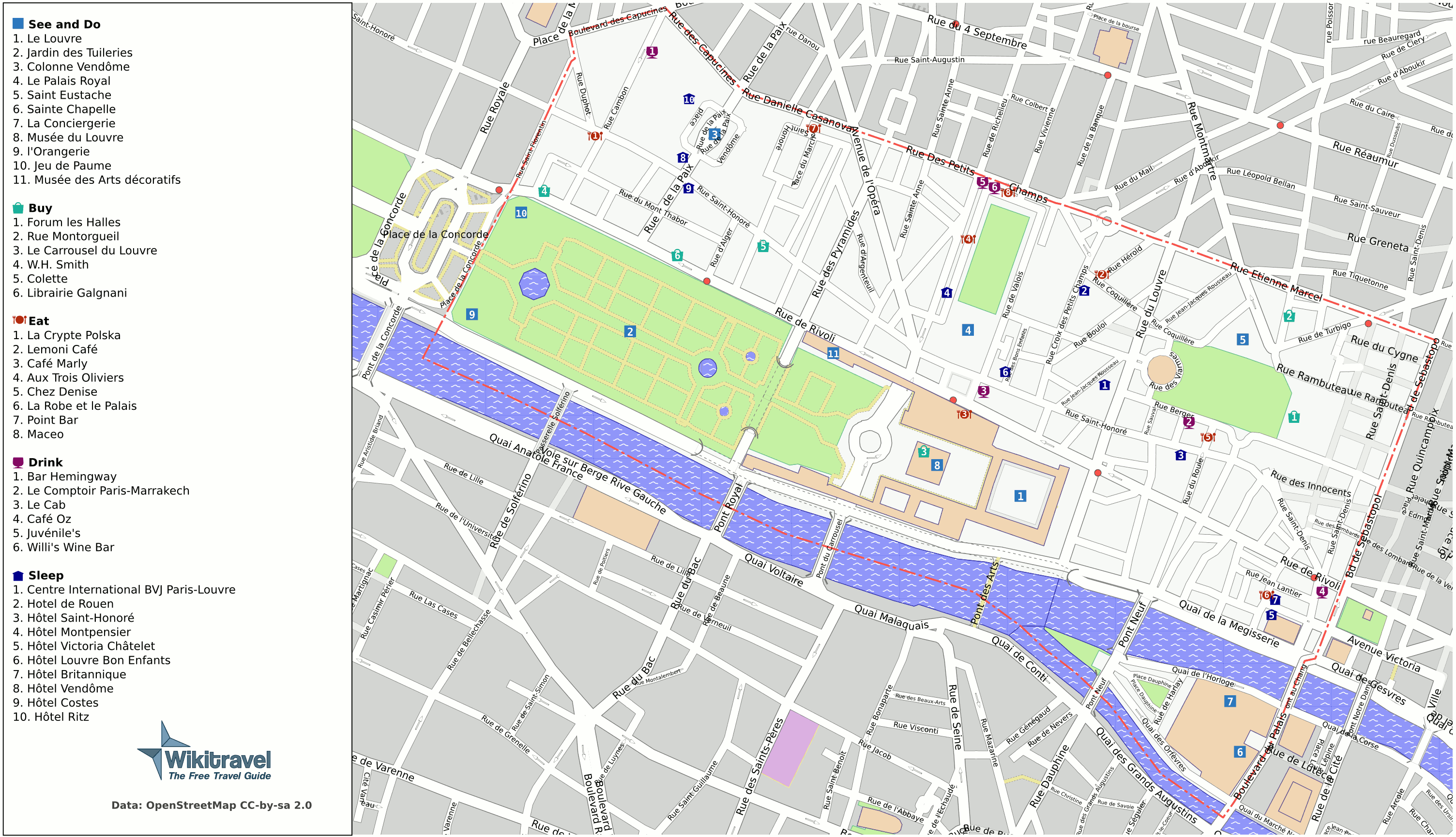
Original file (3,008 × 1,730 pixels, file size: 501 KB, MIME type: image/png)
Annotated map of the 1st arrondissement of Paris. By Mark Jaroski and other users of Wikitravel, based on OSM data. Original at [1].
![[1]](http://wikitravel.org/en/Image:Paris_1st_map.png)
This is a Featured image, which means that it has been identified as one of the best examples of OpenStreetMap mapping, or that it provides a useful illustration of the OpenStreetMap project. If you know another image of similar quality, you can nominate it on Featured image proposals.
Front-page image on 19 Apr 2008
File history
Click on a date/time to view the file as it appeared at that time.
| Date/Time | Thumbnail | Dimensions | User | Comment | |
|---|---|---|---|---|---|
| current | 10:30, 12 April 2008 | | 3,008 × 1,730 (501 KB) | Jpatokal (talk | contribs) | Annotated map of the 1st arrondissement of Paris. By Mark Jaroski and other users of Wikitravel, based on OSM data. Original at [http://wikitravel.org/en/Image:Paris_1st_map.png]. |
You cannot overwrite this file.
File usage
The following file is a duplicate of this file (more details):
- File:Paris 1st map.png from Wikimedia Commons
The following 4 pages use this file: