File:Pateros Mapping Party before and after.png
Jump to navigation
Jump to search

Size of this preview: 392 × 600 pixels. Other resolutions: 157 × 240 pixels | 314 × 480 pixels | 850 × 1,300 pixels.
Original file (850 × 1,300 pixels, file size: 414 KB, MIME type: image/png)
Information
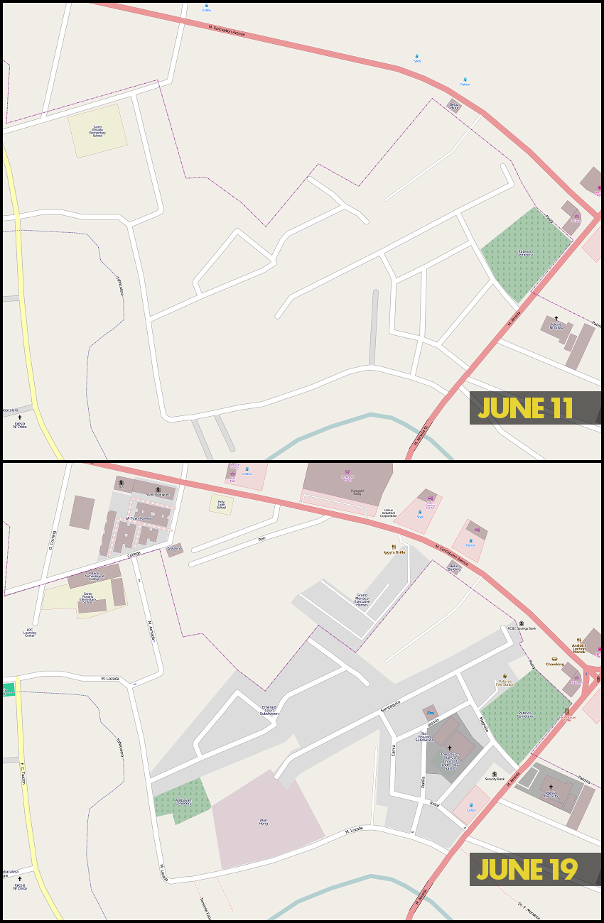
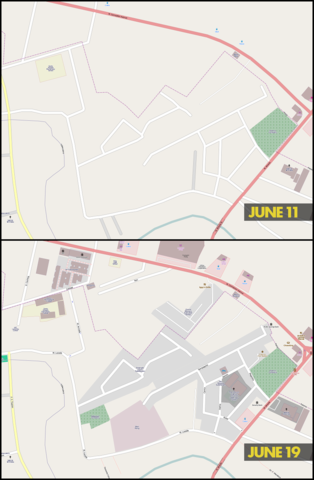
| Description | Mapnik rendering of parts of Sto. Rosario, Pateros and Buting and San Joaquin, Pasig before (June 11) and after (June 19) the Pateros Mapping Party last June 11, 2011. |
|---|---|
| Author | seav |
| Source | OSM (Mapnik layer) (permalink to map) |
| Date | 2011-06-19 |
| Permission | CC-BY-SA 3.0 |
![]()
Contains map data © OpenStreetMap contributors, made available under the terms of the Creative Commons Attribution-ShareAlike 2.0 (CC-BY-SA-2.0).
File history
Click on a date/time to view the file as it appeared at that time.
| Date/Time | Thumbnail | Dimensions | User | Comment | |
|---|---|---|---|---|---|
| current | 08:50, 19 June 2011 | | 850 × 1,300 (414 KB) | Seav (talk | contribs) | ==Information== {{Information |Description = Mapnik rendering of parts of Sto. Rosario, Pateros and Buting and San Joaquin, Pasig before (June 11) and after (June 19) the Pateros Mapping Party last June 11, 2011. |Source = OSM (Mapnik layer |
You cannot overwrite this file.
File usage
The following page uses this file: