File:Patterson substation.png
Jump to navigation
Jump to search


Size of this preview: 600 × 600 pixels. Other resolutions: 240 × 240 pixels | 480 × 480 pixels | 768 × 768 pixels | 1,200 × 1,200 pixels.
Original file (1,200 × 1,200 pixels, file size: 262 KB, MIME type: image/png)
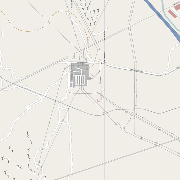
Power lines, substations, wind farms and wind turbines in California.
http://www.openstreetmap.org/?lat=37.70873&lon=-121.56188&zoom=15&layers=B00FT
This is a Featured image, which means that it has been identified as one of the best examples of OpenStreetMap mapping, or that it provides a useful illustration of the OpenStreetMap project. If you know another image of similar quality, you can nominate it on Featured image proposals.
Front-page image on 21 Jun 2008
![]()
Contains map data © OpenStreetMap contributors, made available under the terms of the Creative Commons Attribution-ShareAlike 2.0 (CC-BY-SA-2.0).
File history
Click on a date/time to view the file as it appeared at that time.
| Date/Time | Thumbnail | Dimensions | User | Comment | |
|---|---|---|---|---|---|
| current | 22:17, 16 June 2008 | | 1,200 × 1,200 (262 KB) | Ojw (talk | contribs) | Power lines, substations, wind farms and wind turbines in California. http://www.openstreetmap.org/?lat=37.70873&lon=-121.56188&zoom=15&layers=B00FT |
You cannot overwrite this file.
File usage
The following 2 pages use this file: