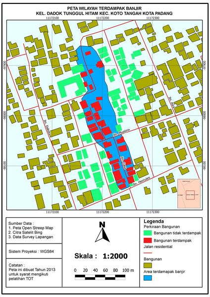
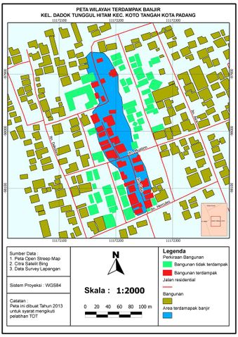
File:Peta Daerah Terdampak Banjir.jpeg
Jump to navigation
Jump to search


Size of this preview: 424 × 600 pixels. Other resolutions: 170 × 240 pixels | 339 × 480 pixels | 768 × 1,086 pixels.
Original file (768 × 1,086 pixels, file size: 184 KB, MIME type: image/jpeg)
File history
Click on a date/time to view the file as it appeared at that time.
| Date/Time | Thumbnail | Dimensions | User | Comment | |
|---|---|---|---|---|---|
| current | 12:21, 28 March 2013 | | 768 × 1,086 (184 KB) | Depci (talk | contribs) |
You cannot overwrite this file.
File usage
The following 2 pages use this file: