File:Photo triangulation eg.png
Jump to navigation
Jump to search

Size of this preview: 800 × 498 pixels. Other resolutions: 320 × 199 pixels | 640 × 399 pixels | 955 × 595 pixels.
Original file (955 × 595 pixels, file size: 159 KB, MIME type: image/png)
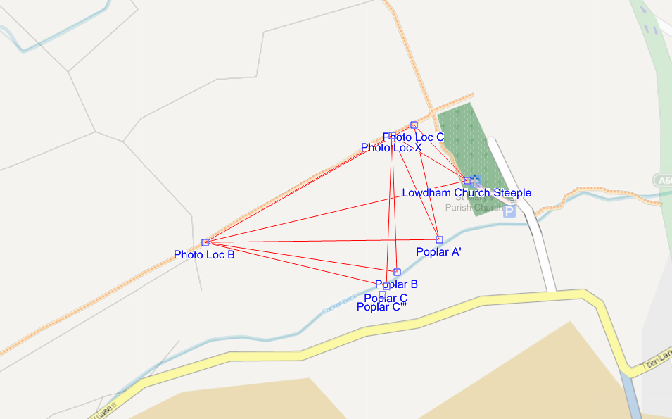
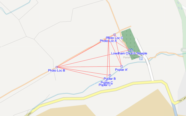
Bearings from photo points A, B, and C overlaid on OSM data using Kosmos.
File history
Click on a date/time to view the file as it appeared at that time.
| Date/Time | Thumbnail | Dimensions | User | Comment | |
|---|---|---|---|---|---|
| current | 18:36, 10 July 2009 | | 955 × 595 (159 KB) | SK53 (talk | contribs) | Bearings from photo points A, B, and C overlaid on OSM data using Kosmos. |
You cannot overwrite this file.
File usage
The following page uses this file: